<?xml version="1.0" encoding="utf-8"?><feed xmlns="http://www.w3.org/2005/Atom" ><generator uri="https://jekyllrb.com/" version="3.10.0">Jekyll</generator><link href="https://dotsconnect.us/feed.xml" rel="self" type="application/atom+xml" /><link href="https://dotsconnect.us/" rel="alternate" type="text/html" /><updated>2025-01-17T17:42:31+00:00</updated><id>https://dotsconnect.us/feed.xml</id><title type="html">Tim Welch</title><subtitle>Crafting technology solutions and creating value for clients around the world</subtitle><entry><title type="html">Through the Fire</title><link href="https://dotsconnect.us/articles/through-the-fire/" rel="alternate" type="text/html" title="Through the Fire" /><published>2023-10-11T00:00:00+00:00</published><updated>2023-10-11T00:00:00+00:00</updated><id>https://dotsconnect.us/articles/through-the-fire</id><content type="html" xml:base="https://dotsconnect.us/articles/through-the-fire/"><![CDATA[<figure>
    <a href="/files/NACIS_2023_printed.jpg"><img src="/files/NACIS_2023_printed.jpg" /></a>
    <figcaption></figcaption>
</figure>

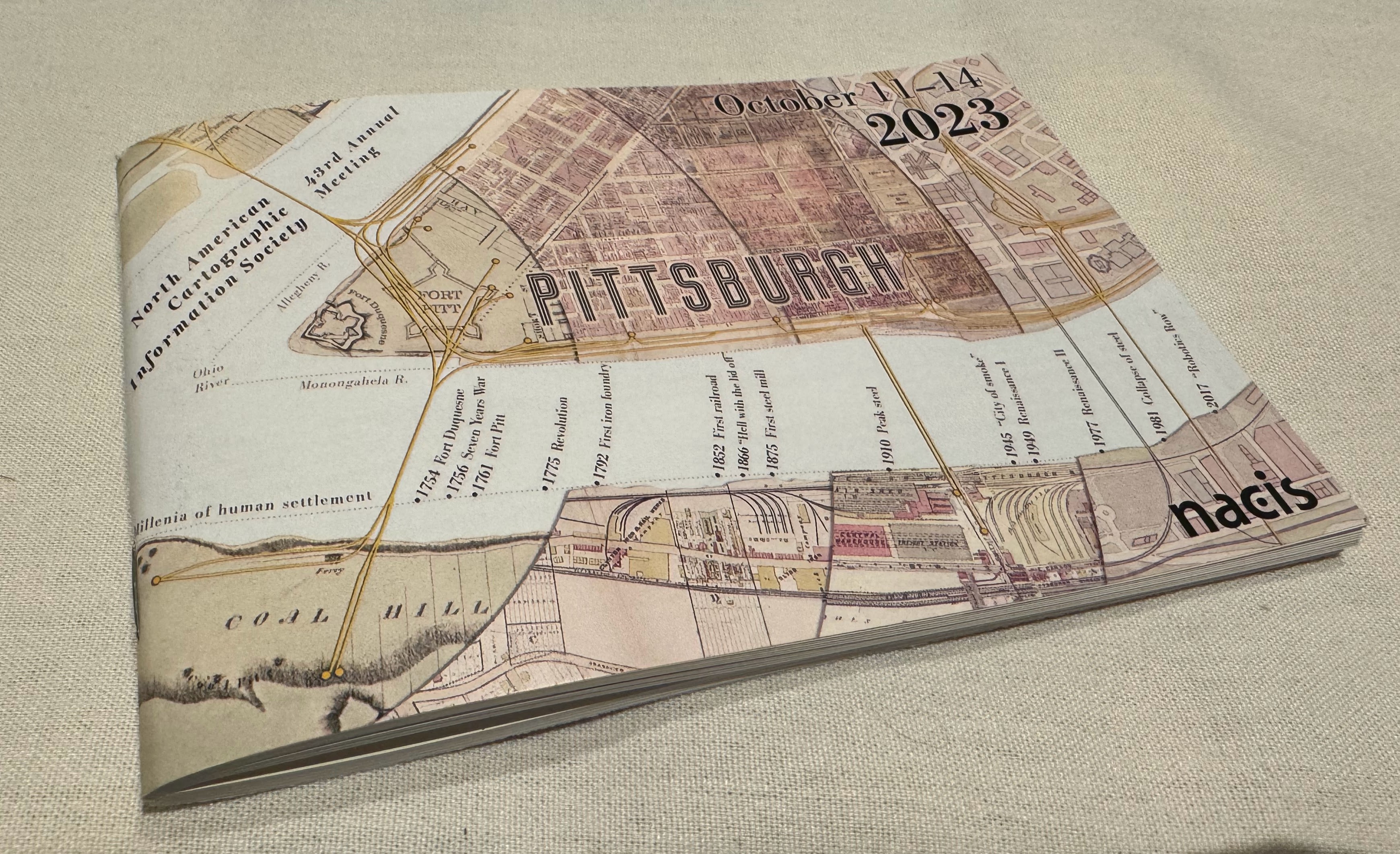
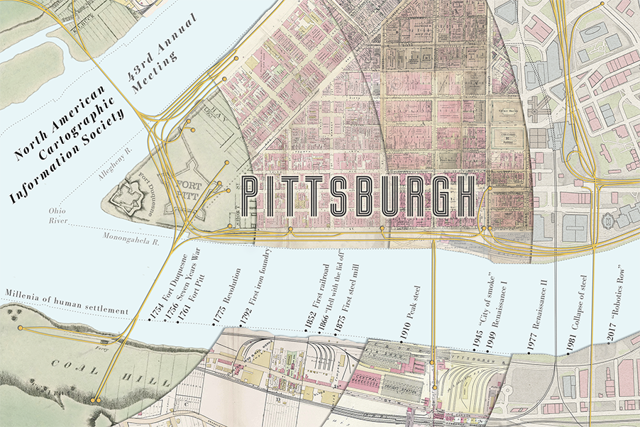
<p>Through the Fire is a postcard-size view into the history of Pittsburgh, created for the NACIS conference program. With an abundance of detail and few words, it elicits more questions than it answers.  It’s an invitation for attendees to dig deeper.</p>

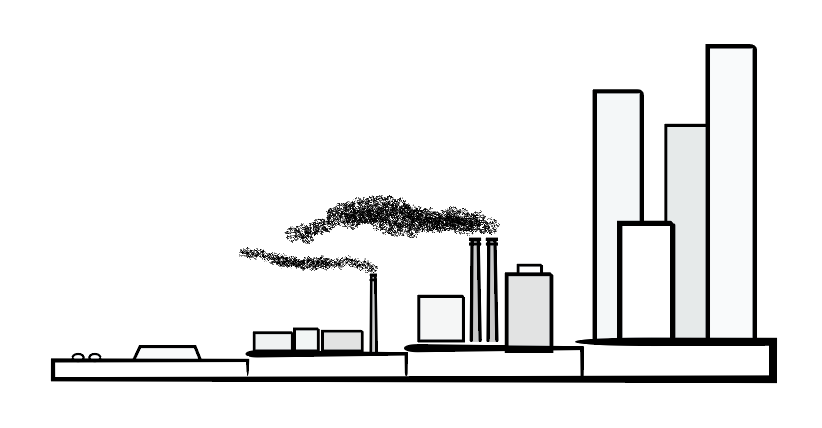
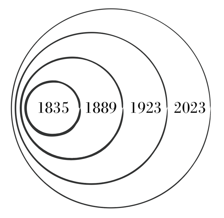
<p>Beginning at the confluence of the Allegheny and Monongahela rivers, the map spreads outward through time in concentric circles, from European colonization, to American Revolution and the discovery of coal. It hints that as the city grew into the steel capital of the world, its natural landscape was devastated. Then as its industrial engine faltered, large-scale urban renewal methods were used to try to clean it up.  Today, the city continues to redefine and rediscover itself.</p>

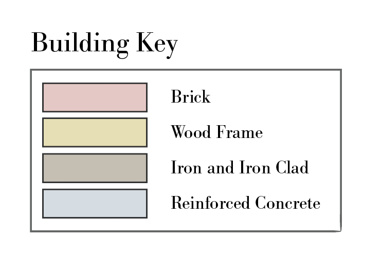
<p>Hints of these transitions can be seen in the density of rail, building footprints, and the type of building material used.</p>

<figure>
    <a href="/files/Cover_v3_600ppi_nobleed.png"><img src="/files/Cover_v3_600ppi_nobleed.png" /></a>
    <figcaption></figcaption>
</figure>

<figure class="half">
    <a href="/files/key.png"><img src="/files/key.png" /></a>
    <figcaption></figcaption>
</figure>

<h2 id="cartographers-notes">Cartographer’s Notes</h2>

<p>I love making small maps, and really had to challenge myself to pull this idea together.  There is so much detail in the sources that it became more of an exercise in taking away than adding.</p>

<p>I chose the orientation and scale to allow NACIS attendees to hold the map in their hand, look out over “the Mon” river from Station Square, and imagine what’s under the edges of the city. To get a small sense of just how much this place and its people have been through.</p>

<figure class="half">
    <a href="/files/NACIS_2023_sideview.png"><img src="/files/NACIS_2023_sideview.png" /></a>
    <figcaption></figcaption>
</figure>

<p>The concept of layers of time isn’t new, but the addition of concentric circles, like the rings of a tree, was a new revelation to me.</p>

<figure class="half">
    <a href="/files/NACIS_2023_rings.png"><img src="/files/NACIS_2023_rings.png" /></a>
    <figcaption></figcaption>
</figure>

<h2 id="map-sources">Map Sources</h2>

<p>This work builds upon the work of others.  Historical maps were sourced online from <a href="https://historicpittsburgh.org/pittsburgh-maps">Historic Pittsburgh</a> and ESRI to represent each of the first 3 segments. In order as they appear from left to right</p>

<ul>
  <li>Map of Pittsburgh 1835 prepared by Lewis Keyon</li>
  <li>Map of Pittsburgh 1889 by Sanborn and GM Hopkins</li>
  <li>Map of Pittsburgh 1923 by Sanborn and GM Hopkins.</li>
  <li>The modern day map and elements unifying all 4 time periods were created using data from OpenStreetMap contributors. <a href="https://openstreetmap.org/copyright">https://openstreetmap.org/copyright</a>.</li>
</ul>

<h2 id="articles-and-archives">Articles and Archives</h2>

<ul>
  <li><a href="https://www.timetoast.com/timelines/major-events-in-pittsburgh">Major events in Pittsburgh</a></li>
  <li><a href="https://www.smartcitiesdive.com/ex/sustainablecitiescollective/rebirth-pittsburgh-s-strip-district/181506/">Urban Renewal: The Rebirth of Pittsburgh’s Strip District</a></li>
  <li><a href="https://pittsburghquarterly.com/articles/a-very-brief-history-of-pittsburgh/">A Very Short History of Pittsburgh</a></li>
  <li><a href="https://en.wikipedia.org/wiki/Pittsburgh_coal_seam">Pittsburgh coal seam - Wikipedia</a></li>
  <li><a href="https://positivelypittsburgh.com/pairofrenaissances/">A Pair of Pittsburgh Renaissances</a></li>
  <li><a href="https://positivelypittsburgh.com/a-journey-into-pittsburghs-early-years/">A Journey into Pittsburgh’s Early Years</a></li>
  <li><a href="https://theincline.com/2019/10/02/pittsburghpedia-the-making-of-robotics-row-coined-locally-and-known-globally/">Pittsburghpedia: The Making of Robotics Row</a></li>
  <li><a href="https://en.wikipedia.org/wiki/Mount_Washington,_Pittsburgh_(mountain)">Mount Washington - Pittsburgh Wikipedia</a></li>
</ul>

<h2 id="disclaimers">Disclaimers</h2>

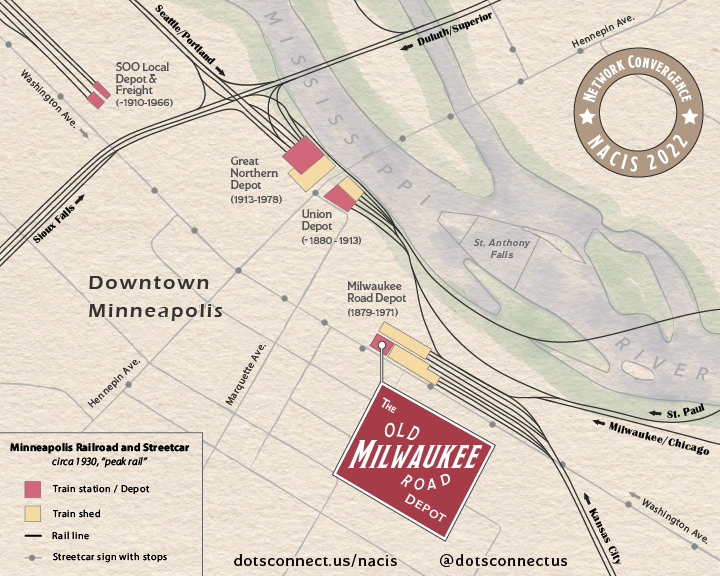
<p>The original historical maps were modified in the making of this new map, mostly in the removal or moving of labels and elements to simplify the overall map.  It was created for the enjoyment of the conference attendees and not as an accurate representation of the area.</p>]]></content><author><name></name></author><category term="articles" /><category term="nacis" /><category term="history" /><category term="storytelling" /><summary type="html"><![CDATA[NACIS 2023 Program Maps]]></summary></entry><entry><title type="html">Footsteps of the Old Milwaukee Road</title><link href="https://dotsconnect.us/articles/footsteps/" rel="alternate" type="text/html" title="Footsteps of the Old Milwaukee Road" /><published>2022-10-18T00:00:00+00:00</published><updated>2022-10-18T00:00:00+00:00</updated><id>https://dotsconnect.us/articles/footsteps</id><content type="html" xml:base="https://dotsconnect.us/articles/footsteps/"><![CDATA[<p>The Milwaukee Road rail line had a long history.  It’s official name, which tells you more about its geographic range, is the Chicago, Milwaukee, St. Paul and Minneapolis Railroad.  The line ran through the Milwaukee Road Depot in Minneapolis, which was itself a convergence for many other train lines.</p>

<p>“The Depot” is also the host of the NACIS 2022 conference.  This inspired me to create a map that dug deeper into this rail-focused past and connected it with its present use.</p>

<figure class="half">
    <a href="/files/NacisDepotV2.png"><img src="/files/NacisDepotV2.png" /></a>
    <figcaption></figcaption>
</figure>

<h2 id="theme">Theme</h2>
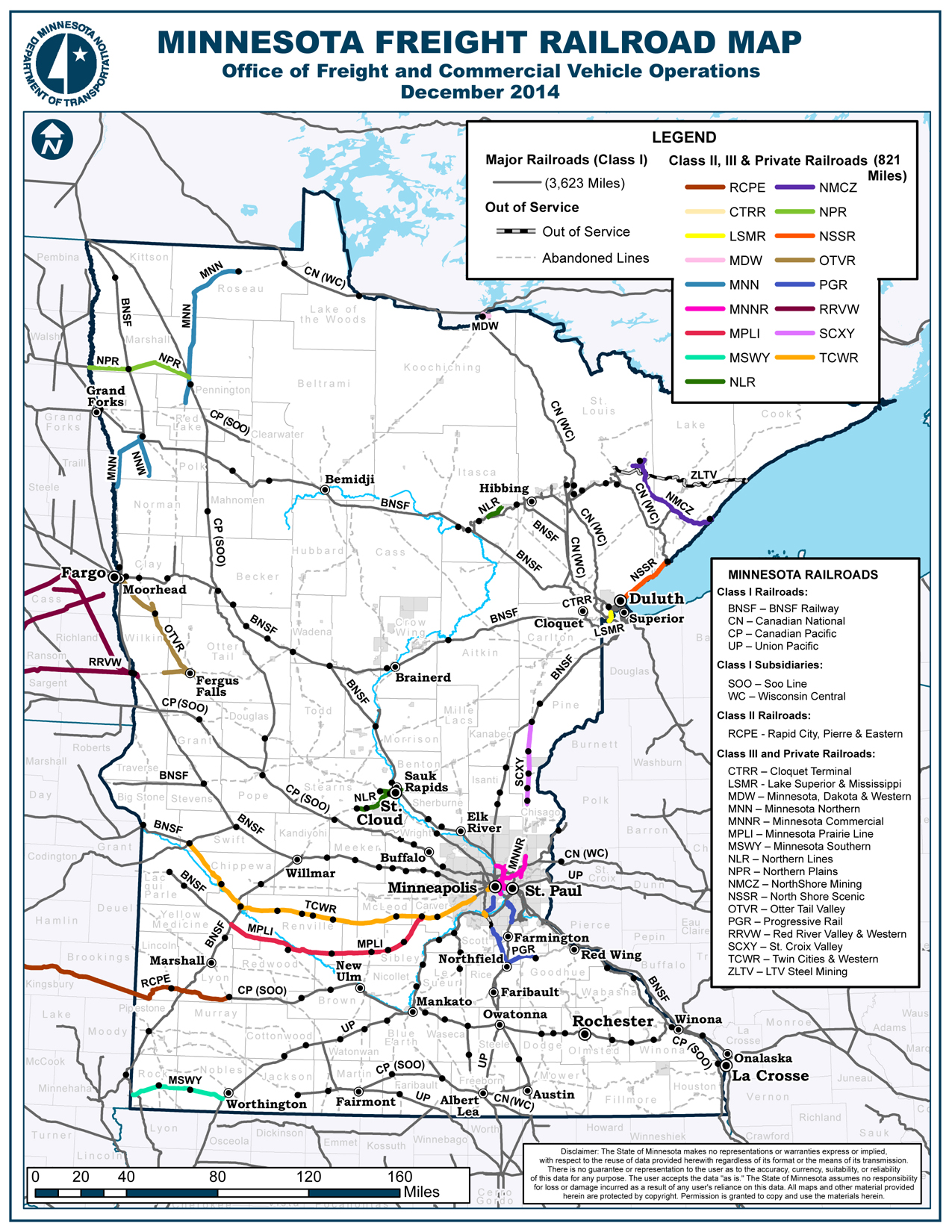
<p>This map is meant to show just how prevalent rail was in Minneapolis through its peak in the 1920’s.  This includes longer haul railroad and local streetcar lines.  After this peak, the highway system came online and rail use, both passenger and freight, started to dwindle. But at one time there were at least 4 significant freight depots or trains stations just in the downtown Minneapolis area, serving 10’s of thousands of passengers a day and a significant amount of freight.</p>

<p>For the NACIS event, people would be coming from near and far, so the map imagines these people coming in on these rail lines of the past. Arrows show where they might have been coming in from.</p>

<p>Here’s a short list of the online sources I used:</p>
<h2 id="maps">Maps</h2>
<ul>
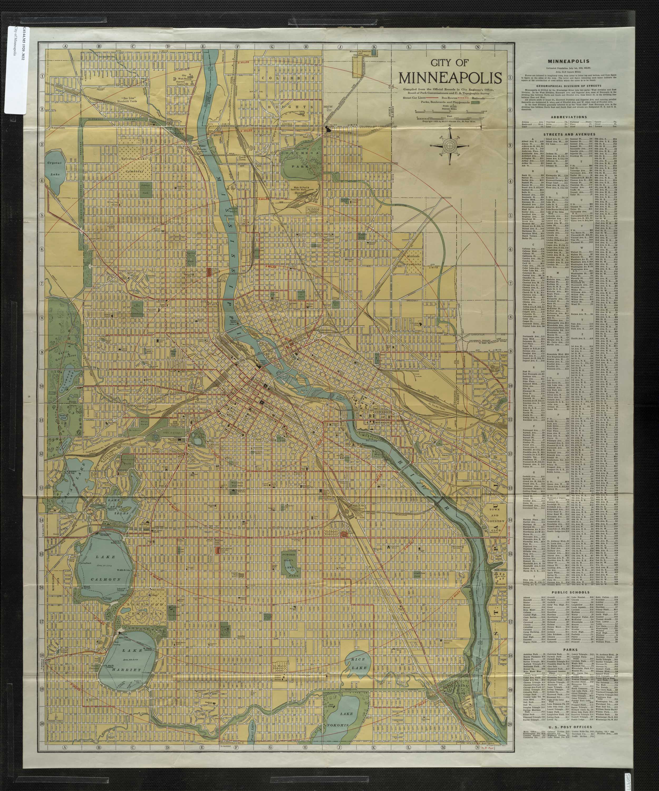
  <li><a href="http://geo.lib.umn.edu/twin_cities_maps/reference/map01453.jpg">City of Minneapolis (1919)</a></li>
  <li><a href="https://www.davidrumsey.com/luna/servlet/detail/RUMSEY~8~1~201687~3000656:Minneapolis-and-Vicinity-?sort=Pub_List_No_InitialSort%2CPub_Date%2CPub_List_No%2CSeries_No&amp;qvq=w4s:/where%2FMinneapolis%2B(Minn.);q:minneapolis;sort:Pub_List_No_InitialSort%2CPub_Date%2CPub_List_No%2CSeries_No;lc:RUMSEY~8~1&amp;mi=33&amp;trs=40">Minneapolis and Vicinity (1924)</a></li>
  <li><a href="https://archives.lib.umn.edu/repositories/22/resources/8875">City of Minneapolis (1910?)</a></li>
  <li><a href="https://www.ruralmn.org/wp-content/uploads/2015/01/MNRailMapShortlines.jpg">Minnesota Freight Railroad Map (2014)</a></li>
</ul>

<h2 id="articles-and-archives">Articles and Archives</h2>
<ul>
  <li><a href="https://en.wikipedia.org/wiki/Minneapolis_station_(Milwaukee_Road)">Wikipedia - Milwaukee Station</a></li>
  <li><a href="https://en.wikipedia.org/wiki/Milwaukee_Road">Wikipedia - Milwaukee Road</a></li>
  <li><a href="https://gettingaroundmpls.wordpress.com/2011/11/16/tracks-of-the-past/">Getting Around Minneapolis - Tracks of the Past</a></li>
  <li><a href="http://millcitytimes.com/news/the-great-northern-depot.html">Mill City Times - The Great Northern Depot</a></li>
</ul>

<h2 id="inspiration">Inspiration</h2>
<ul>
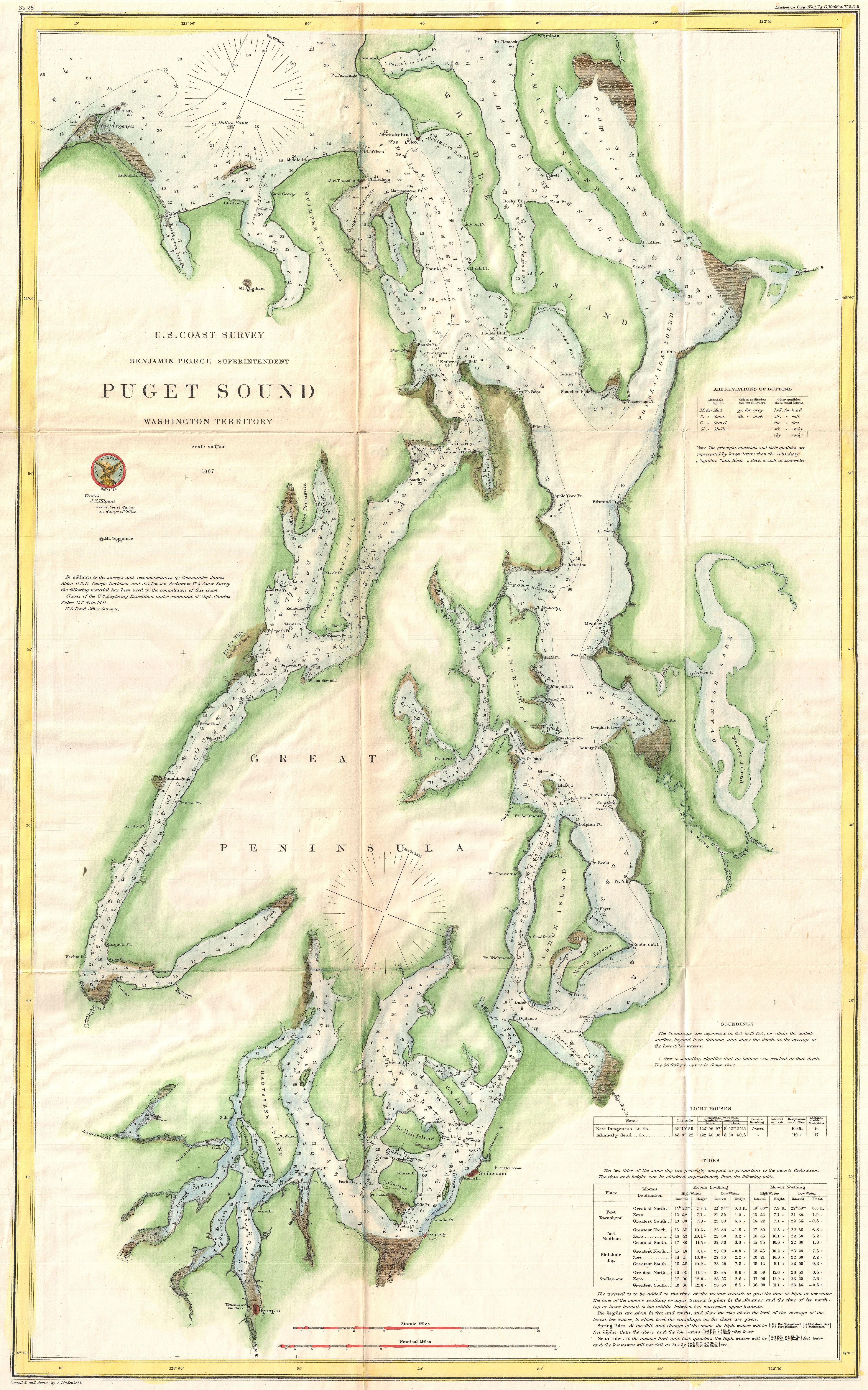
  <li><a href="https://upload.wikimedia.org/wikipedia/commons/2/29/1867_U.S._Coast_Survey_Chart_or_Map_of_Puget_Sound%2C_Washington_-_Geographicus_-_PugetSound-uscs-1867.jpg">US Coast Survey Chart</a></li>
</ul>

<h2 id="process">Process</h2>

<p>My main sources were the rail line maps from 1910-1930.  I georeferenced these maps and added some modern reference layers from Living Atlas.  I then exported the whole package to Illustrator.</p>

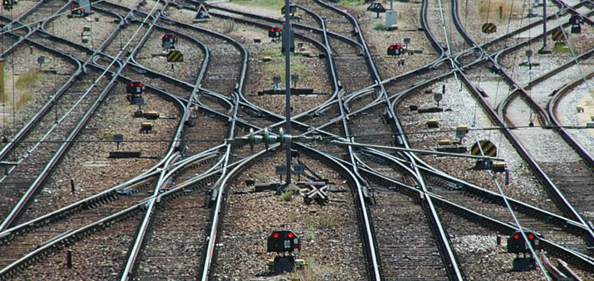
<p>Now to me, rail lines are not rough, or jagged.  They look and feel very smooth, strong.  Long stretches of rail, sometimes as far as the eye can see, straight as an arrow with turns in sweeping arcs both long and short.  To capture this, I used the Curvature Tool.  I didn’t trace every track, far from that, but I did want to show that trains came and went from many directions and that stations could have multiple trains at the station at one time.  In reality, near every depot has a “yard” with many parallel rail lines splitting and merging with each other, with switches upon switches to transition between.  Here’s a picture just to give you an idea.</p>

<figure class="half">
    <a href="/images/posts/milwaukee/rail-switching.png"><img src="/images/posts/milwaukee/rail-switching.png" /></a>
    <figcaption>Switching Yard</figcaption>
</figure>

<p>I chose not to include roads, buildings, and other elements of an early industrial city.  The streetcar lines and a few street labels hint at the grid-like structure in place.</p>

<p>The watercolor background is a nod to survey charts from the later 1800’s that would be used to indicate waters, shoreline, etc.  Just a splash of color to bring the otherwise simple linework and labeling to life.  It’s a background element so a little goes a long way.  I used Adobe Fresco with a Surface Pencil for this, though other software could certainly be used.</p>

<p>A Milwaukee Depot sign was created to round out the map and bring focus to the Depot itself as the center of attention.  The layout and lettering of the sign is directly inspired by Milwaukee Road signs of the era.</p>

<h2 id="disclaimers">Disclaimers</h2>
<p>This map has not been expert reviewed, it’s based solely on online research, and historical maps that don’t always line up.  It’s also not meant to be comprehensive:</p>

<ul>
  <li>Roads and vehicle only river crossings were intentionally left out of the map.</li>
  <li>The railroad lines and streetcar tracks are not accurate in number or to a specific snapshot in time.  The intention was to focus around the peak in the 1920’s and give a feel for just how rail focused the city was.  Looking at enough maps, it’s clear that both large rail lines and streetcar lines were in flux through the 1920’s and 1930’s.  By the 1940’s many of them were starting to be ripped out.  The age of rail was over.</li>
</ul>]]></content><author><name></name></author><category term="articles" /><category term="nacis" /><category term="railroad" /><category term="storytelling" /><summary type="html"><![CDATA[creating a map for nacis 2022]]></summary></entry><entry><title type="html">A Year With Mapbox GL</title><link href="https://dotsconnect.us/articles/mapglefforts/" rel="alternate" type="text/html" title="A Year With Mapbox GL" /><published>2016-09-15T00:00:00+00:00</published><updated>2016-09-15T00:00:00+00:00</updated><id>https://dotsconnect.us/articles/mapglefforts</id><content type="html" xml:base="https://dotsconnect.us/articles/mapglefforts/"><![CDATA[<p>It’s been a year since I picked up the Mabox GL Javascript library.  Since then it’s steadily improved and become stable across desktop and mobile.  It’s now my mapping client of choice for most my projects.  Here’s a quick summary of my tinkering over the last year.</p>

<ul>
  <li>I started with designing and presenting some <a href="http://dotsconnect.us/articles/happy-place/">compelling maps</a> with Studio</li>
  <li>I then started integrating Mapbox GL JS with React and Redux, creating a simple single-page <a href="https://reactmaps.firebaseapp.com">app template</a> - published on <a href="https://github.com/twelch/react-mapbox-gl-seed">Github</a>.  Since then Uber has put out a more proper <a href="https://github.com/uber/react-map-gl">React component</a> for GL JS that follows the style <a href="https://www.mapbox.com/blog/mapbox-gl-js-reactive/">proposed by tmcw</a>.</li>
  <li>Client work then took me down the path of storytelling and playing out choreographed scenes on a map, starting with <a href="http://bl.ocks.org/twelch/18d53240f638d0c77cd4">animating objects along a path</a> and progressing to <a href="http://bl.ocks.org/twelch/0ae8d02c78542a772401">layering in video and camera movement</a>.</li>
  <li>Clustering support came to GL JS during the summer and I put that to use in a successful <a href="/articles/workzonewtf/">social media campaign</a></li>
  <li>Prototypes are fun to create but my clients want full-featured responsive apps with token-based auth, multi-tenancy, and internationalization.  So I took things further creating a lightweight <a href="https://github.com/twelch/kit-client-react">client</a> and <a href="https://github.com/twelch/kit-server-hapi">server</a> pair for quickly publishing map views.  I was able to take advantage of added GL JS support for switching languages and using Webpack.</li>
  <li>I found that my use cases for GL JS were growing increasingly complex, and at least once I found an <a href="https://github.com/mapbox/mapbox-gl-js/issues/2926">obscure bug</a> that most would never hit.</li>
</ul>]]></content><author><name></name></author><category term="articles" /><category term="mapbox" /><category term="react" /><category term="animation" /><category term="storytelling" /><summary type="html"><![CDATA[making the switch to Mapbox GL in app dev]]></summary></entry><entry><title type="html">Crowdsourcing Policy Change in PDX</title><link href="https://dotsconnect.us/articles/workzonewtf/" rel="alternate" type="text/html" title="Crowdsourcing Policy Change in PDX" /><published>2016-06-28T00:00:00+00:00</published><updated>2016-06-28T00:00:00+00:00</updated><id>https://dotsconnect.us/articles/workzonewtf</id><content type="html" xml:base="https://dotsconnect.us/articles/workzonewtf/"><![CDATA[<p>Right now there are dozens of road closures impacting the pedestrian and bike networks in and around the boom town that is Portland.  They range from unnecessary inconveniences to downright dangerous, and they all are easily preventable.</p>

<figure class="third">
  <div class="twidget">
    <blockquote class="twitter-tweet" data-lang="en"><p lang="en" dir="ltr"><a href="https://twitter.com/hashtag/workzoneWTF?src=hash">#workzoneWTF</a> About 5100 block on SW Barbur northbound. Posted 45mph.  This was today 4/19/2015. No bike lane detour. <a href="https://t.co/NvuZ7FuvHU">pic.twitter.com/NvuZ7FuvHU</a></p>&mdash; Seth D. Alford (@setha45) <a href="https://twitter.com/setha45/status/722477768340996096">April 19, 2016</a></blockquote>
  </div>
  <script async="" src="//platform.twitter.com/widgets.js" charset="utf-8"></script>
</figure>

<p>Yet, local transportation agencies and developers weren’t convinced it was a big issue so a small group of us set out to capture just how bad things have gotten and push for the policy changes needed to address it.  We ran a short social media campaign over three months and with a little tech sauce we whipped up, we were able to aggregate hundreds of photo tweets from some dedicated individuals and submit them to City Hall as part of a proposed resolution to work zone closure requirements.  The resolution passed unanimously at the end of June!  Here’s how we did it.</p>

<p>Oregon Walks and the Bicycle Transportation Alliance approached me with the social media campaign idea and I hatched a plan for a tech workflow that would:</p>

<ul>
  <li>Make it simple for people to contribute images via Twitter and Instragram</li>
  <li>Collect contributions for review and approval (Zapier, Google Sheets, Google Apps Script)</li>
  <li>Publish approved contributions through a central website (Jekyll/Github Pages, Tabletop.JS, Mapbox GL JS)</li>
  <li>Be built entirely on free or low cost services</li>
</ul>

<figure>
  <a href="/images/posts/workzonewtf/workflow.jpg"><img style="margin: 0 auto; width:400px" src="/images/posts/workzonewtf/workflow.jpg" /></a>
</figure>

<p>In just a few short sprints we had something <a href="http://vzwz.oregonwalks.org/">up and running</a>.  Code available on <a href="https://github.com/pdxosgeo/workzonepdx">Github</a></p>

<figure>
  <a href="/images/posts/workzonewtf/home-top.jpg"><img src="/images/posts/workzonewtf/home-top.jpg" /></a>
</figure>
<figure>
  <a href="/images/posts/workzonewtf/home-map.jpg"><img src="/images/posts/workzonewtf/home-map.jpg" /></a>
</figure>

<p>Oregon Walks and BTA then went into action and got the word out to their networks.  The sightings started to <a href="https://twitter.com/search?q=%23workzonewtf&amp;src=typd">trickle in</a>.</p>

<figure class="third">
  <div class="twidget">
    <blockquote class="twitter-tweet" data-lang="en"><p lang="en" dir="ltr">Demonstrate need for work zone policies that provide safe route for walking &amp; biking! Snap photos &amp; tag <a href="https://twitter.com/hashtag/WorkZoneWTF?src=hash">#WorkZoneWTF</a> <a href="https://t.co/KW7hnZ1BUp">https://t.co/KW7hnZ1BUp</a></p>&mdash; BTA (@BTAOregon) <a href="https://twitter.com/BTAOregon/status/724987883942195200">April 26, 2016</a></blockquote>
  </div>
  <div class="twidget">
    <blockquote class="twitter-tweet" data-lang="en"><p lang="en" dir="ltr">Let&#39;s <a href="https://twitter.com/hashtag/crowdsource?src=hash">#crowdsource</a> work zone closures for <a href="https://twitter.com/OregonWalks">@OregonWalks</a> &amp; <a href="https://twitter.com/BTAOregon">@BTAOregon</a>! <a href="https://twitter.com/hashtag/VisionZero?src=hash">#VisionZero</a> <a href="https://twitter.com/hashtag/workzoneWTF?src=hash">#workzoneWTF</a> <a href="https://twitter.com/hashtag/ATSummit?src=hash">#ATSummit</a> <a href="https://t.co/WCIqnArIpM">https://t.co/WCIqnArIpM</a></p>&mdash; Ray Atkinson (@RayPlans) <a href="https://twitter.com/RayPlans/status/709854607745286144">March 15, 2016</a></blockquote>
  </div>
  <div class="twidget">
    <blockquote class="twitter-tweet" data-lang="en"><p lang="en" dir="ltr">Portlanders - when you see work zones with no pedestrian accommodation tweet it to <a href="https://twitter.com/hashtag/workzoneWTF?src=hash">#workzoneWTF</a> <a href="https://twitter.com/hashtag/ATSummit?src=hash">#ATSummit</a> <a href="https://t.co/KQWA0DOVvV">https://t.co/KQWA0DOVvV</a></p>&mdash; Evan Manvel (@evanmanvel) <a href="https://twitter.com/evanmanvel/status/709863386666766336">March 15, 2016</a></blockquote>
  </div>
</figure>

<p>We <a href="https://twitter.com/vzworkzones">communicated directly</a> with contributors to fill in gaps and provide encouragement.</p>

<figure class="half">
  <div class="twidget">
    <blockquote class="twitter-tweet" data-lang="en"><p lang="en" dir="ltr">.<a href="https://twitter.com/CLeonard46">@CLeonard46</a> thank you, we need more outer SE! Added to the map @ <a href="https://t.co/Ate6WwUgDP">https://t.co/Ate6WwUgDP</a></p>&mdash; VZ Work Zones (@vzworkzones) <a href="https://twitter.com/vzworkzones/status/730922748688535552">May 13, 2016</a></blockquote>
  </div>
  <div class="twidget">
    <blockquote class="twitter-tweet" data-lang="en"><p lang="en" dir="ltr">.<a href="https://twitter.com/AdamHerstein">@AdamHerstein</a> What&#39;s the intersection here so we can place on the map at <a href="https://t.co/Ate6WwUgDP">https://t.co/Ate6WwUgDP</a>?  Thanks</p>&mdash; VZ Work Zones (@vzworkzones) <a href="https://twitter.com/vzworkzones/status/725785266196123649">April 28, 2016</a></blockquote>
  </div>
</figure>

<p>Over time a wide swath of safety and accessibility issues were shared covering everything from large long-term building construction and roadway maintenance to temporary closures.  More than a few times both sides of the street would be closed, or car parking would be maintained while bike or pedestrian traffic would be blocked.  Far too often work signage, equipment, even port-a-potties would be placed unnecessarilyin the middle of bike lanes or sidewalks forcing people out of their lane of travel.</p>

<figure class="third">
  <div class="twidget">
    <blockquote class="twitter-tweet" data-lang="en"><p lang="und" dir="ltr"><a href="https://twitter.com/hashtag/sidewalkends?src=hash">#sidewalkends</a> <a href="https://twitter.com/hashtag/workzoneWTF?src=hash">#workzoneWTF</a> <a href="https://twitter.com/OregonWalks">@OregonWalks</a> <a href="https://t.co/hplgDCXdOJ">pic.twitter.com/hplgDCXdOJ</a></p>&mdash; Kari Schlosshauer (@galavantista) <a href="https://twitter.com/galavantista/status/725522059485286400">April 28, 2016</a></blockquote>
  </div>
  <div class="twidget">  
    <blockquote class="twitter-tweet" data-lang="en"><p lang="en" dir="ltr">PBOT has both sidewalks on SE 11th closed at Caruthers. <a href="https://twitter.com/hashtag/WorkZoneWTF?src=hash">#WorkZoneWTF</a> <a href="https://t.co/VTmrAbkycC">pic.twitter.com/VTmrAbkycC</a></p>&mdash; Carl Larson (@LilBikesBigFun) <a href="https://twitter.com/LilBikesBigFun/status/742446668478484481">June 13, 2016</a></blockquote>
  </div>
  <script async="" src="//platform.twitter.com/widgets.js" charset="utf-8"></script>
</figure>

<p>About halfway into the campaign, contributors started sharing examples of good closures, cases where the developer or the city took a little extra time to create a viable alternative for bikes and pedestrians or found a way to prevent a closure altogether.  New hashtags emerged including <a href="https://twitter.com/search?q=%23workzoneftw&amp;src=typd">#workzoneFTW</a> and <a href="https://twitter.com/search?q=%23workzonewtg&amp;src=typd">#workzoneWTG</a>!</p>

<figure class="third">
  <div class="twidget">
    <blockquote class="twitter-tweet" data-lang="en"><p lang="en" dir="ltr">Bikes don&#39;t need much space to squeeze past construction. Way to go (WTG), <a href="https://twitter.com/PBOTinfo">@PBOTinfo</a> ! <a href="https://twitter.com/hashtag/workzoneWTG?src=hash">#workzoneWTG</a> not <a href="https://twitter.com/hashtag/workzoneWTF?src=hash">#workzoneWTF</a> <a href="https://t.co/99JIa9Du5U">pic.twitter.com/99JIa9Du5U</a></p>&mdash; Carl Larson (@LilBikesBigFun) <a href="https://twitter.com/LilBikesBigFun/status/718559751701790720">April 8, 2016</a></blockquote>
  </div>
  <div class="twidget">
    <blockquote class="twitter-tweet" data-lang="en"><p lang="en" dir="ltr">Thanks <a href="https://twitter.com/tvaarchitects">@tvaarchitects</a> for providing a ped path on Hawthorne at 31st! <a href="https://twitter.com/hashtag/workzoneFTW?src=hash">#workzoneFTW</a> not <a href="https://twitter.com/hashtag/workzonewtf?src=hash">#workzonewtf</a> is possible! <a href="https://t.co/gvp1IQSTpj">pic.twitter.com/gvp1IQSTpj</a></p>&mdash; Oregon Walks (@OregonWalks) <a href="https://twitter.com/OregonWalks/status/743895275652059136">June 17, 2016</a></blockquote>
  </div>
  <div class="twidget">
    <blockquote class="twitter-tweet" data-lang="en"><p lang="en" dir="ltr">A two way protected bike lane through a work zone at NW 13th &amp; Jefferson. Not a <a href="https://twitter.com/hashtag/workzonewtf?src=hash">#workzonewtf</a> <a href="https://t.co/DeW8BCpHCE">pic.twitter.com/DeW8BCpHCE</a></p>&mdash; Nick Falbo (@nickfalbo) <a href="https://twitter.com/nickfalbo/status/733316703988252672">May 19, 2016</a></blockquote>
  </div>
</figure>

<p>After 3 months, all of the contributions were reviewed and submitted to the city and presented in support of new guidelines proposed called <a href="https://www.portlandoregon.gov/transportation/article/579777">Safe Accommodation for Pedestrians and Cyclists In and Around Work Zones</a>.  The Oregonian <a href="http://www.oregonlive.com/commuting/index.ssf/2016/06/closing_sidewalks_bike_lanes_f.html">ran a story</a> covering the issue.</p>

<p>On June 30th a resolution was presented to the city council and passed 5-0.  The end right? No, just the beginning.  Now it’s time to make sure the city and private developers follow through.</p>

<figure class="half">
  <div class="twidget">
    <blockquote class="twitter-tweet" data-conversation="none" data-lang="en"><p lang="en" dir="ltr">“<a href="https://twitter.com/twkovach">@twkovach</a>: This is a good policy <a href="https://t.co/z4i7qAWDL2">https://t.co/z4i7qAWDL2</a>” Portland social media campaign <a href="https://twitter.com/hashtag/WorkZoneWTF?src=hash">#WorkZoneWTF</a> leads to direct action.</p>&mdash; Marc Lefkowitz (@MarcLefkowitz) <a href="https://twitter.com/MarcLefkowitz/status/748568176070365184">June 30, 2016</a></blockquote>
  </div>
  <div class="twidget">
    <blockquote class="twitter-tweet" data-lang="en"><p lang="en" dir="ltr">This is a clear <a href="https://twitter.com/hashtag/WorkZoneWTF?src=hash">#WorkZoneWTF</a>; how did <a href="https://twitter.com/PBOTinfo">@PBOTinfo</a> allow this? What happened to new rules?? <a href="https://t.co/camtU9g2MU">https://t.co/camtU9g2MU</a></p>&mdash; (((PJ))) (@__P__J) <a href="https://twitter.com/__P__J/status/755104355766837248">July 18, 2016</a></blockquote>
  </div>
</figure>]]></content><author><name></name></author><category term="articles" /><category term="workzoneWTF" /><category term="twitter" /><category term="zapier" /><category term="mapbox" /><category term="google app script" /><summary type="html"><![CDATA[Using social networks to show that construction closures are endangering bikes and pedestrians]]></summary><media:thumbnail xmlns:media="http://search.yahoo.com/mrss/" url="https://dotsconnect.us/%7B%22feature%22=%3E%22posts/workzonewtf/closure.jpg%22%7D" /><media:content medium="image" url="https://dotsconnect.us/%7B%22feature%22=%3E%22posts/workzonewtf/closure.jpg%22%7D" xmlns:media="http://search.yahoo.com/mrss/" /></entry><entry><title type="html">The Joy of Mapmaking with Bob Ross</title><link href="https://dotsconnect.us/articles/happy-place/" rel="alternate" type="text/html" title="The Joy of Mapmaking with Bob Ross" /><published>2015-11-01T00:00:00+00:00</published><updated>2015-11-01T00:00:00+00:00</updated><id>https://dotsconnect.us/articles/happy-place</id><content type="html" xml:base="https://dotsconnect.us/articles/happy-place/"><![CDATA[<p>Yesterday I lead a fun session at Wherecamp PDX.  I’d been working on a Halloween costume of the late great Bob Ross so I embraced it and in the classic format of his PBS show <a href="https://en.wikipedia.org/wiki/The_Joy_of_Painting">Joy of Painting</a> I took people through creating and publishing a map in just a half hour.</p>

<p>There. It’s just that easy.</p>

<table>
  <tr>
    <td valign="top">
      <blockquote class="twitter-tweet" lang="en"><p lang="en" dir="ltr">Is that Bob Ross at <a href="https://twitter.com/hashtag/WhereCampPDX?src=hash">#WhereCampPDX</a> ? <a href="https://t.co/Q9J1nf4fpX">pic.twitter.com/Q9J1nf4fpX</a></p>&mdash; Justin C. Houk (@GEOpdx) <a href="https://twitter.com/GEOpdx/status/660826698611470336">November 1, 2015</a></blockquote>
    </td>
    <td valign="top">
      <blockquote class="twitter-tweet" lang="en"><p lang="en" dir="ltr">The joy of mapping with Bob Ross! (And QGis, Mapbox Studio, React JS, and...) <a href="https://twitter.com/hashtag/WhereCampPDX?src=hash">#WhereCampPDX</a> <a href="https://t.co/zdVCfWItfa">pic.twitter.com/zdVCfWItfa</a></p>&mdash; WhereCamp PDX! (@WhereCampPDX) <a href="https://twitter.com/WhereCampPDX/status/660519787362029568">October 31, 2015</a></blockquote>
    </td>
  </tr>
</table>
<script async="" src="//platform.twitter.com/widgets.js" charset="utf-8"></script>

<p>Check out the interactive final product below complete with happy trees, clouds, squirrels, and a heatmap of furry travels as they forage and build giant acorn stashes.  I used some of my favorite tools including the new Mapbox Studio, Sketch, The Noun Project, and QGIS.  We then published the map as a simple web app using React and Firebase.  I did not create the data however.  Can you guess what I used?  <a href="http://civicapps.org">civicapps.org</a> was my friend this time.</p>

<p>I hope you enjoy and read on for some of my workflow details.</p>

<iframe width="100%" height="400" src="https://the-happy-place.firebaseapp.com/" frameborder="0" allowfullscreen=""></iframe>

<p><a href="https://the-happy-place.firebaseapp.com/" target="_blank">View fullscreen in new tab</a></p>

<h1 id="the-blank-canvas">The Blank Canvas</h1>

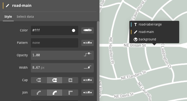
<p>In Mapbox Studio your blank canvas will often be one of the pre-styled global street maps lovingly extracted from OpenStreetMap by the Mapbox team.  I chose the light basemap to focus the viewer on the data I was going to layer on top.  I then made the background color a little warmer and toggled off the display of any unnecessary layers including buildings and most labeling.  Studio has a nice feature where you can click any feature on the map and jump right into editing its style.  This is expected in graphic design software, but a global basemap?  This is a pretty big leap forward.</p>

<figure>
    <a href="/images/posts/joyofmap/stylemenu.jpg"><img src="/images/posts/joyofmap/stylemenu.jpg" /></a>
</figure>

<h1 id="icon-design">Icon Design</h1>

<p>All of my icons I found at <a href="https://thenounproject.com/">The Noun Project</a>.  Seriously they have icons for everything.  You can use any of them for free if you give credit.</p>

<ul>
  <li><a href="https://thenounproject.com/icon/88105/">Tree</a> created by Matthew Hawdon</li>
  <li><a href="https://thenounproject.com/icon/16683/">Squirrel</a> created by Andy Beksa</li>
  <li><a href="https://thenounproject.com/icon/1685/">Acorn</a> created by Proletkult Graphic, GB</li>
  <li><a href="https://thenounproject.com/icon/3765/">Cloud</a> created by James Fenton</li>
  <li><a href="https://thenounproject.com/icon/96901/">Rain</a> created by Lloyd Humphries, DK</li>
</ul>

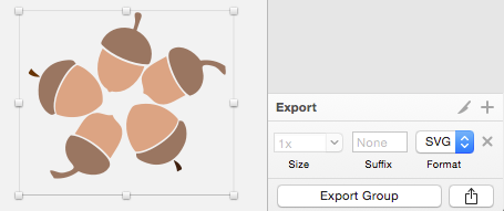
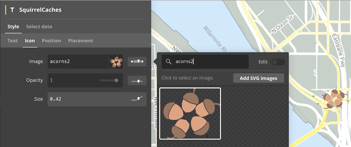
<p>I was able to import each icon in SVG format directly into <a href="https://www.sketchapp.com/">Sketch</a>, my vector editing tool of choice next to <a href="https://inkscape.org/en/">Inkscape</a>.  Sketch is not a full-blown vector editor but I’m able to adjust color and size as well as duplicate and mash them up into new icons.  The final product is then exported as a new SVG and imported into Studio.  Some nice features are available for choosing what zoom levels the icons should appear at and how they should scale in size as you zoom in and out.  Very slick.</p>

<figure>
    <a href="/images/posts/joyofmap/acorn-pile.png"><img src="/images/posts/joyofmap/acorn-pile.png" /></a>
    <figcaption>Exporting from Sketch</figcaption>
</figure>

<figure>
    <a href="/images/posts/joyofmap/acorns-add.jpg"><img src="/images/posts/joyofmap/acorns-add.jpg" /></a>
    <figcaption>Importing into Studio</figcaption>
</figure>

<h1 id="data">Data</h1>

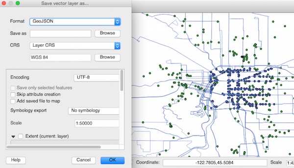
<p>I found all of the data I needed at Portland’s <a href="http://civicapps.org">civicapps.org</a>.  To load it into Mapbox Studio I only needed to convert it to the WGS84 reference system (longitude/latitude decimal degrees) from the local Oregon State Plane system.  Quantum GIS easily did this by loading the dataset and saving as GeoJSON WGS84.</p>

<figure>
    <a href="/images/posts/joyofmap/qgis.jpg"><img src="/images/posts/joyofmap/qgis.jpg" /></a>
</figure>

<h1 id="the-polish">The Polish</h1>

<p>To finish the map off I added some linework for squirrel paths.  These styled semi-transparent, maybe only 20% opacity, so that where multiple paths overlapped there would be more intense color, signifying you know higher density squirrel traffic ;)</p>

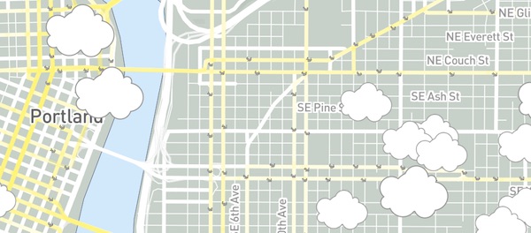
<p>I also added in some clouds that vary in size based on their size attribute. The clouds also appear and disappear as you zoom in and out giving a more interactive feel.  Completely for show but an interesting touch I think that takes interactive maps to another level.</p>

<figure>
    <a href="/images/posts/joyofmap/clouds.jpg"><img src="/images/posts/joyofmap/clouds.jpg" /></a>
</figure>

<h1 id="the-app">The App</h1>

<p>But wait we’re not done yet.  Once the map style is published we’ve just gotten started.  The map style is now available via the Mapbox style API and can be consumed by any mapping library that support the style and vector tiles spec.  For this example I used the <a href="https://www.mapbox.com/mapbox-gl-js/">Mapbox GL Javascript library</a> and wrapped it into a simple <a href="https://github.com/twelch/react-mapbox-gl-js">React app</a> that I put together.  It’s not production-ready code but if React is your framework of choice it lets you get a map up and running in the browser quickly and get a feel for how it will work on a variety of devices.  Nice!</p>

<p>With just a few more steps you can then publish this little app prototype on the web using the <a href="https://www.firebase.com/docs/hosting/">Firebase static hosting service</a>.  The interactive map above is my published map that I put into an iframe.</p>

<p>There’s much more you can do with the GL JS library including interacting with map features, filtering and restyling layers on-the-fly, tilting and rotating the map, and more.  I’m currently working on a production-ready starter project using the GL JS library, React, and webpack.  Keep an eye on the Github repository for more.</p>

<h1 id="wrap">Wrap</h1>

<p>So that’s it, I hope you enjoyed getting a glimpse into one possible workflow.  I have high hopes for this software stack and look forward to publishing some production apps in the coming months.  Until next time.</p>

<figure>
    <a href="/images/posts/joyofmap/wave.gif"><img src="/images/posts/joyofmap/wave.gif" /></a>
</figure>]]></content><author><name></name></author><category term="articles" /><category term="mapbox" /><category term="studio" /><category term="noun project" /><category term="sketch" /><category term="react" /><category term="firebase" /><summary type="html"><![CDATA[Bob Ross tribute map created using Mapbox Studio, Sketch, and Portland open data]]></summary></entry><entry><title type="html">iNaturalist @ Oaks Bottom Refuge</title><link href="https://dotsconnect.us/articles/inaturalist-oaks/" rel="alternate" type="text/html" title="iNaturalist @ Oaks Bottom Refuge" /><published>2015-04-09T00:00:00+00:00</published><updated>2015-04-09T00:00:00+00:00</updated><id>https://dotsconnect.us/articles/inaturalist-oaks</id><content type="html" xml:base="https://dotsconnect.us/articles/inaturalist-oaks/"><![CDATA[<p>9 of us came together this last weekend to geek out on plants in the Oaks Bottom Wildlife Refuge and document them using the iNaturalist mobile app.  Thanks to my friend <a href="https://twitter.com/CutoffMountain">Ethan</a> for helping spot the location, the flowers and trees were just starting to bloom.  I’ll be back to pick some Elderberries later in the season :)</p>

<figure>
    <a href="/images/posts/inat1/book.jpg"><img src="/images/posts/inat1/book.jpg" /></a>
    <figcaption>Matt perusing the plant ID book</figcaption>
</figure>
<figure>
    <a href="/images/posts/inat1/pond.jpg"><img src="/images/posts/inat1/pond.jpg" /></a>
    <figcaption>Scoping birds near the pond</figcaption>
</figure>

<p>I must say the iNaturalist team has put together a nice little app, I’m impressed.  And if you submit incomplete observations, like if you didn’t know the species name, the community jumps right in to make recommendations, sometimes within an hour!  I’ll be curious to see how well their current architecture scales, so far they have over 1.2M observations.</p>

<figure>
    <a href="/images/posts/inat1/look.jpg"><img src="/images/posts/inat1/look.jpg" /></a>
</figure>

<p>The group was a lot of fun, the sun came out, and we had a nice little feast at the end.  Stay tuned for our next activity, ping me if you’d like to be notified.</p>]]></content><author><name></name></author><category term="articles" /><category term="inaturalist" /><category term="mobile" /><category term="botany" /><category term="pie" /><summary type="html"><![CDATA[Success hosting our first plant observation activity using iNaturalist]]></summary><media:thumbnail xmlns:media="http://search.yahoo.com/mrss/" url="https://dotsconnect.us/%7B%22feature%22=%3E%22posts/inat1/flower.jpg%22,%20%22credit%22=%3E%22Tim%20Welch,%20Oaks%20Bottom%20Wildlife%20Refuge%22%7D" /><media:content medium="image" url="https://dotsconnect.us/%7B%22feature%22=%3E%22posts/inat1/flower.jpg%22,%20%22credit%22=%3E%22Tim%20Welch,%20Oaks%20Bottom%20Wildlife%20Refuge%22%7D" xmlns:media="http://search.yahoo.com/mrss/" /></entry><entry><title type="html">Happy Fish 2 - Mobile Survey Expansion</title><link href="https://dotsconnect.us/articles/hapi-fis-2/" rel="alternate" type="text/html" title="Happy Fish 2 - Mobile Survey Expansion" /><published>2015-04-05T00:00:00+00:00</published><updated>2015-04-05T00:00:00+00:00</updated><id>https://dotsconnect.us/articles/hapi-fis-2</id><content type="html" xml:base="https://dotsconnect.us/articles/hapi-fis-2/"><![CDATA[<p>16 months ago I departed from the Solomon Islands, enjoying the success of jumpstarting the <a href="http://voices.nationalgeographic.com/2013/11/12/mobile-apps-a-path-back-to-traditional-fishing-knowledge/">Happy Fish mobile survey program</a> with a team of dedicated fisheries officers, biologists, technologists, and surveyors.  Fast forward and the Hapi Fis team is now celebrating 8000 surveys collected from fish vendors in 5 markets, and have now successfully expanded the program to a second province, Gizo.</p>

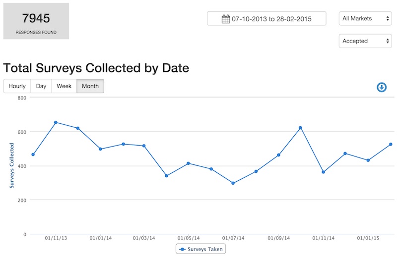
<figure>
  <a href="/images/posts/hapifis2/surveychart.jpg"><img src="/images/posts/hapifis2/surveychart.jpg" /></a>
  <figcaption>Surveys reviewed and accepted over the 16 month period</figcaption>
</figure>

<p>Along the way the survey team never missed a market day and managed to lose only one phone!  Truly a great accomplishment and a testament to the dedication of the team and the power of the platform developed by Point 97 to streamline the entire survey workflow.  This was the first time a baseline of reef fishery data had been successfully collected using mobile phones.</p>

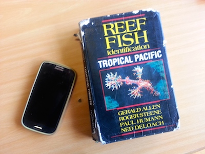
<figure>
  <a href="/images/posts/hapifis2/book-phone.jpg"><img src="/images/posts/hapifis2/book-phone.jpg" /></a>
  <figcaption>Standard issue phone and fish ID book</figcaption>
</figure>

<h1 id="phase-2">Phase 2</h1>

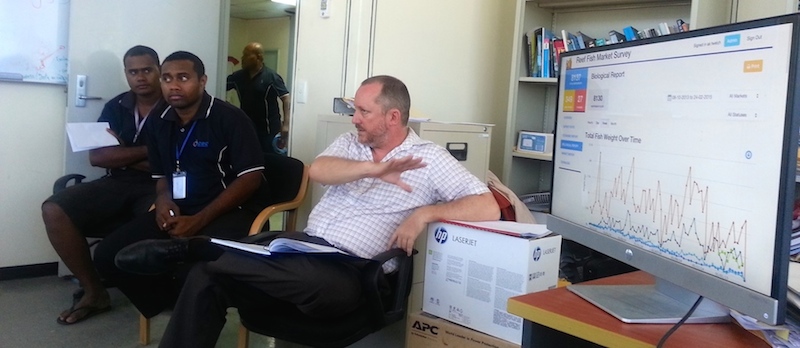
<p>By all measures phase 1 of Hapi Fis was a success.  The Ministry could now see how much fish was coming into the markets and where it was coming from.  They also now had a more direct line of communication from vendors to understand changing conditions for buying, transporting, and selling fish.  That storm this week over in Isabel province? It’s delaying fishing shipments.  That extra glut of fish coming through the market over the last month?  It’s coming from another province and isn’t letting up which means a likely increase in fishing pressure there.  Something to keep a closer eye on.</p>

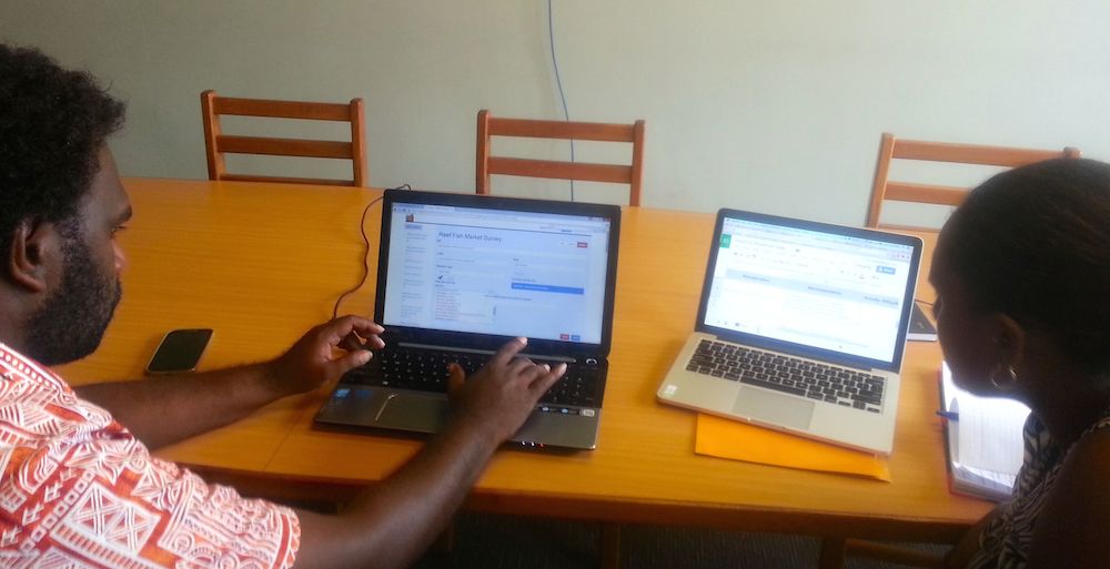
<figure>
  <a href="/images/posts/hapifis2/office.jpg"><img src="/images/posts/hapifis2/office.jpg" /></a>
  <figcaption>Survey coordinators David Fatai and Jan Pitu reviewing incoming survey responses</figcaption>
</figure>

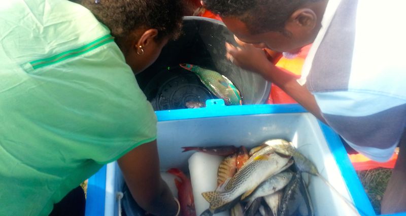
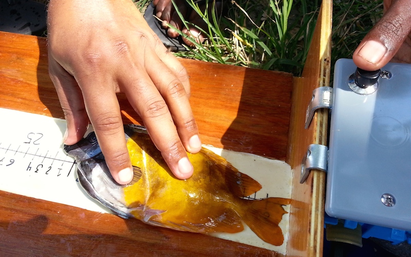
<p>The information coming in is at a frequency and level of quality that the Ministry has never had before.  But it needs to go deeper.  Because in order to make larger management decisions they need to be able to pinpoint issues with specific species, gear types, and months of the year (when those species spawn). This means capturing individual fish measurements including length, weight, and sexual maturity of the more than 100 species of reef fish that come through the markets.  Gaining access to the vendors catch at this level was not going to be easy.</p>

<h1 id="training">Training</h1>

<p>To move things forward I was asked to return to the Solomon Islands in February with Dr. Kevin Rhodes.  In 2 short weeks we were able to work with the team to enhance the survey, and train on identifying and measuring fish at the species level.  The survey team was really up for the task and came early and stayed late in order to maximize their time with us.</p>

<figure>
  <a href="/images/posts/hapifis2/kev-instruct.jpg"><img src="/images/posts/hapifis2/kev-instruct.jpg" /></a>
  <figcaption>Dr. Rhodes walking through the process of sorting and measuring fish</figcaption>
</figure>

<figure>
  <a href="/images/posts/hapifis2/fishsort.jpg"><img src="/images/posts/hapifis2/fishsort.jpg" /></a>
  <figcaption>Practicing sorting and weighing by fish family</figcaption>
</figure>

<p>Dr. Rhodes even brought along a nice setup for rapid photographing and measurement of the fish so that they could be identified and entered at a later time if needed.</p>

<figure>
  <a href="/images/posts/hapifis2/photo-system.jpg"><img src="/images/posts/hapifis2/photo-system.jpg" /></a>
  <figcaption></figcaption>
</figure>

<figure>
  <a href="/images/posts/hapifis2/measure.jpg"><img src="/images/posts/hapifis2/measure.jpg" /></a>
  <figcaption></figcaption>
</figure>

<h1 id="system-transition">System Transition</h1>

<p>In the midst of all this activity, I found time to make some bug fixes and work with the new central Government IT Support Unit to test out the transition of Hapi Fis to their infrastructure.  It’s impressive what their group has accomplished centralizing the systems of all of the different ministries.</p>

<figure>
  <a href="/images/posts/hapifis2/ictsu.jpg"><img src="/images/posts/hapifis2/ictsu.jpg" /></a>
  <figcaption>Briefing the ICTSU team</figcaption>
</figure>

<h1 id="security">Security</h1>

<p>The ministry continues to find additional value in the data they’ve collected. Late last year one of the longtime vendors was trying to acquire a bank loan and didn’t have the necessary records to prove their sales history.  The ministry was able to provide an official report using the information from Hapi Fis and the loan was approved.  It’s these types of incentives that will keep the vendors engaged and willing to continue providing information.</p>

<h1 id="next-steps">Next Steps</h1>

<p>The data for this project is continuing to flood in and Hapi Fis is doing its part to organize it and provide insight.  Naturally, as soon as you answer one question with the data it leads to two new ones and its easy to get lost down the rabbit hole.  One thing is for sure, reef fish is a key source of food for the country and all signs point to diminishing returns in the face of a rising population.  The ministry knows that action needs to be taken and that they need to involve the public in the process.  The question is what action are they going to take?</p>

<figure>
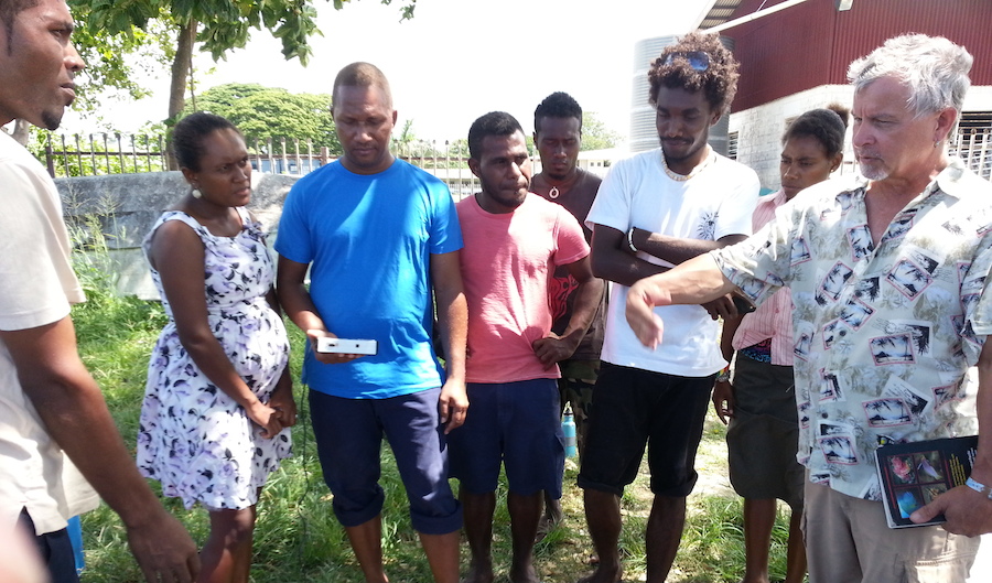
  <a href="/images/posts/hapifis2/gizo.jpg"><img src="/images/posts/hapifis2/gizo.jpg" /></a>
  <figcaption>Fisherman selling his catch for the day.  Undersize fish are a common occurrence.</figcaption>
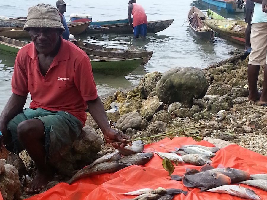
</figure>]]></content><author><name></name></author><category term="articles" /><category term="project" /><category term="pacific" /><category term="reef" /><category term="livelihood" /><category term="mobile" /><category term="assessment" /><category term="training" /><summary type="html"><![CDATA[16 months ago I departed from the Solomon Islands, enjoying the success of jumpstarting the Happy Fish mobile survey program with a team of dedicated fisheries officers, biologists, technologists, and surveyors. Fast forward and the Hapi Fis team is now celebrating 8000 surveys collected from fish vendors in 5 markets, and have now successfully expanded the program to a second province, Gizo.]]></summary><media:thumbnail xmlns:media="http://search.yahoo.com/mrss/" url="https://dotsconnect.us/%7B%22feature%22=%3E%22posts/hapifis2/mobile-cover.jpeg%22,%20%22credit%22=%3E%22Tim%20Welch,%20Surveyor%20Training%20@%20Ministry%20of%20Fisheries,%20Solomon%20Islands%22%7D" /><media:content medium="image" url="https://dotsconnect.us/%7B%22feature%22=%3E%22posts/hapifis2/mobile-cover.jpeg%22,%20%22credit%22=%3E%22Tim%20Welch,%20Surveyor%20Training%20@%20Ministry%20of%20Fisheries,%20Solomon%20Islands%22%7D" xmlns:media="http://search.yahoo.com/mrss/" /></entry><entry><title type="html">Arduino Project - Weather Station</title><link href="https://dotsconnect.us/articles/weather-station/" rel="alternate" type="text/html" title="Arduino Project - Weather Station" /><published>2015-03-17T00:00:00+00:00</published><updated>2015-03-17T00:00:00+00:00</updated><id>https://dotsconnect.us/articles/weather-station</id><content type="html" xml:base="https://dotsconnect.us/articles/weather-station/"><![CDATA[<p>For the last couple months I’ve been prototyping a simple solution for collecting temperature and humidity data using an Arduino and visualizing it online in real-time.  It’s been a fun experience from soldering connections and writing Arduino sketches in C to publishing data to the <a href="https://thingspeak.com/">Thingspeak IoT platform</a> and designing a simple web interface for aggregating and visualizing the data.  It’s still a work in progress but I’m ready to share some of my initial work.</p>

<p>All of the code including the Arduino Sketch and Angular app can be found on my <a href="https://github.com/twelch/weather-station">Github project</a></p>

<h1 id="hardware">Hardware</h1>

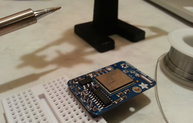
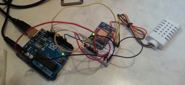
<p>For the hardware I selected the <a href="http://www.adafruit.com/products/500">Arduino Uno R3</a> microcontroller, <a href="http://www.adafruit.com/product/393">AM2302 temperature/humidity sensor</a>, and <a href="http://www.adafruit.com/product/1510">Adafruit CC3000 Wifi Breakout Board</a>.  With all the right parts I was able to put this together in a couple of hours.</p>

<figure class="half">
  <a href="/images/posts/weatherstation/solder.jpg"><img src="/images/posts/weatherstation/solder.jpg" /></a>
  <a href="/images/posts/weatherstation/connect.jpg"><img src="/images/posts/weatherstation/connect.jpg" /></a>
  <figcaption>Soldering the Wifi chip connections and wiring everything up</figcaption>
</figure>

<h1 id="thinkspeak">Thinkspeak</h1>

<p>The next step was to write <a href="https://github.com/twelch/weather-station/blob/master/arduino/CC3000_weather.ino">an Arduino Sketch</a> to collect data from the sensors at a regular interval and send it to Thingspeak over WiFi.  For this I adapted an <a href="https://learn.adafruit.com/adafruit-cc3000-wifi-and-xively">older Adafruit tutorial</a>.</p>

<p>Thingspeak made it easy to setup a new channel to receive the sensor events for both temperature and humidity.  Once the sketch was setup I watched the data start to stream in.</p>

<h1 id="app-design">App Design</h1>

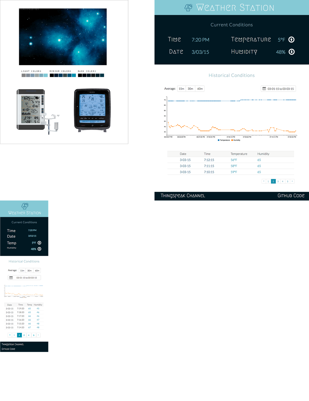
<p>I was just about ready to design the UI, but first I took some time to study the the aggregation features of the Thingspeak API as well as test out the C3.js charting library.  Confident of what these tools could do I found a deep space themed <a href="https://www.tumblr.com/search/space%20palette">palette</a> and sketched out a UI design.</p>

<figure class="half">
  <a href="/images/posts/weatherstation/ui.gif"><img src="/images/posts/weatherstation/ui.gif" /></a>
  <figcaption>Desktop and mobile design comps</figcaption>
</figure>

<h1 id="app-development">App Development</h1>

<p>With the groundwork now laid I’m slowly moving forward with the prototype in my spare time.  I’m going to incorporate a variety of front-end tools including:</p>

<ul>
  <li>Bower</li>
  <li>Gulp</li>
  <li>SASS + Sourcemaps</li>
  <li>Autoprefixer</li>
  <li>Bootstrap</li>
  <li>Angular JS</li>
  <li>Karma test runner</li>
</ul>

<p>Stay tuned for the final results.</p>]]></content><author><name></name></author><category term="articles" /><category term="arduino" /><category term="thingspeak" /><category term="IoT" /><category term="angular" /><category term="d3" /><category term="sass" /><category term="gulp" /><category term="sourcemaps" /><summary type="html"><![CDATA[Creating a simple home weather station with off the shelf hardware, web platforms, and Thingspeak]]></summary></entry><entry><title type="html">Engaging Fisherfolk in the Caribbean</title><link href="https://dotsconnect.us/articles/cnfo-collaboration/" rel="alternate" type="text/html" title="Engaging Fisherfolk in the Caribbean" /><published>2015-03-01T00:00:00+00:00</published><updated>2015-03-01T00:00:00+00:00</updated><id>https://dotsconnect.us/articles/cnfo-collaboration</id><content type="html" xml:base="https://dotsconnect.us/articles/cnfo-collaboration/"><![CDATA[<h1 id="a-network-of-fisherfolk">A Network of Fisherfolk</h1>

<p>As fish abundance decreases, food security is a growing issue in the Caribbean Islands.  At the same time small community-based fisheries in these countries are concerned that their access to traditional fishing grounds are under threat, and with it the ability to maintain their livelihoods, participate in management of the resource, and feed their people.  The Caribbean Network of Fisherfolk Organizations (CNFO) was formed to increase the voice of fisherfolk in the Caribbean region so that they can address these concerns among others.</p>

<p>I’ve had the privilege of meeting Mitch Lay, the coordinator of the CNFO, a few times.  He’s a humble man who would much rather be on his fishing boat or with his family, but he realizes that they are both at risk.  So he spends a lot of time away from home, sharing his message with anyone who will listen.  And it’s hard not to connect with what he has to say.  Listen to a little bit of a speech of his in Guyana last February.</p>

<iframe width="560" height="315" src="https://www.youtube.com/embed/89IEeF44Zh4" frameborder="0"> </iframe>

<h1 id="connecting-the-dots">Connecting the Dots</h1>

<p>Because the CNFO is made up of National Organizations spread across 12 different countries, it’s a challenge for them to collaboarate at a regional scale.  To address this they partnered with the ICT Research Programme at the University of the West Indies, led by Dr. Kim Mallalieu, to create an online engagement platform that they could use for everyday communication and collaboration.  It would integrate tried-and-true tools for virtual communities as well as more modern tools like Google Hangouts and a virtual classroom.</p>

<p>In February the ICT team reached out to me do a rapid assessment of the beta release of their platform.  Their testing had turned up some usability and performance issues and they were still deciding how to best implement the more sophisticated features they had planned.  The project team clearly knew what they were doing and most importantly what they needed the site to do.  What they wanted was some fresh insight.  An outside perspective.</p>

<p>So over the course of a few days I met with the project leads, distilled down their needs and concerns, researched plugins and best design practices for their chosen CMS, tested the current UI workflows against project requirements and usability guidelines, and finally presented a set of pinpoint recommendations.</p>

<p>The feedback was well received, even invigorating for the project team.  I think because I not only offered fresh ideas and solutions they hadn’t considered, I also took the time to affirm many of the things they were already thinking and decisions they had already made.  This gave them renewed confidence and energy that they could take into the next phase of development, and I wish them success.  The fate of some of these small scale fisheries may rely on it.</p>]]></content><author><name></name></author><category term="articles" /><category term="project" /><category term="caribbean" /><category term="engagement" /><category term="fisherfolk" /><category term="livelihood" /><category term="assessment" /><category term="usability" /><summary type="html"><![CDATA[A Network of Fisherfolk]]></summary><media:thumbnail xmlns:media="http://search.yahoo.com/mrss/" url="https://dotsconnect.us/%7B%22feature%22=%3E%22posts/cnfo/soufriere.jpg%22,%20%22credit%22=%3E%22Tim%20Welch,%20Soufriere,%20St.%20Lucia%22%7D" /><media:content medium="image" url="https://dotsconnect.us/%7B%22feature%22=%3E%22posts/cnfo/soufriere.jpg%22,%20%22credit%22=%3E%22Tim%20Welch,%20Soufriere,%20St.%20Lucia%22%7D" xmlns:media="http://search.yahoo.com/mrss/" /></entry><entry><title type="html">Connecting the Dots of 2014</title><link href="https://dotsconnect.us/articles/years-dots/" rel="alternate" type="text/html" title="Connecting the Dots of 2014" /><published>2014-12-30T00:00:00+00:00</published><updated>2014-12-30T00:00:00+00:00</updated><id>https://dotsconnect.us/articles/years-dots</id><content type="html" xml:base="https://dotsconnect.us/articles/years-dots/"><![CDATA[<p>Change is the only constant this last year with highs and lows that have given me great pause.  I’ve been off in uncharted territory for a while now and it’s time for some self-reflection and connecting the dots.</p>

<h1 id="point-97-and-ecotrust">Point 97 and Ecotrust</h1>

<p>For 7 years at Ecotrust I took on and navigated different roles from exploring the deepest depths of the code mines to inspiring teams and clients to execute on grand visions of open source software.  Together we built a foundation that allowed a team of us to spin-off a for-profit marine consulting company, Point 97.  It was a risk but we took the plunge.</p>

<figure class="half">
	<a href="/images/posts/2014dots/djc_Madrona_Software.jpg"><img src="/images/posts/2014dots/djc_Madrona_Software.jpg" /></a>
	<a href="/images/posts/2014dots/sitka-top-boat.jpeg"><img src="/images/posts/2014dots/sitka-top-boat.jpeg" /></a>	
	<figcaption>Ecotrust home office and field office</figcaption>
</figure>

<figure class="half">
	<a href="/images/posts/2014dots/rafting.jpg"><img src="/images/posts/2014dots/rafting.jpg" /></a>
	<a href="/images/posts/2014dots/cni_vinton_group_shot_2_2.jpg"><img src="/images/posts/2014dots/cni_vinton_group_shot_2_2.jpg" /></a>	
	<figcaption>Typical staff retreat and meeting Vinton Cerf in DC</figcaption>
</figure>

<p>By the time 2014 rolled around Point 97 had already set sail.  It was long days and lots of travel across these oceans of ours.</p>

<figure class="half">
	<a href="/images/posts/2014dots/tim-market-training.jpg"><img src="/images/posts/2014dots/tim-market-training.jpg" /></a>
	<a href="/images/posts/2014dots/ball-beach-market-phone.jpg"><img src="/images/posts/2014dots/ball-beach-market-phone.jpg" /></a>	
	<figcaption>Testing and training surveyors with Happy Fish mobile app in the Solomon Islands</figcaption>
</figure>

<p>I was in a new wide-reaching role in the company covering business development and client relations.  I was without a script or a safety line.  Par for the course with a company bootstrapping itself.  My energy and patience had always seemed endless but was now being put to the test.  My tendency for thoughtful decision-making and reflection was not fitting the volume of work and the expectations that my position required.  I consulted my peers and my mentors.  I read <a href="http://www.amazon.com/Thinking-Fast-Slow-Daniel-Kahneman/dp/0374533555">Thinking, Fast and Slow</a>.</p>

<p>Late Spring I transitioned to working with Point 97 as a consultant.</p>

<h1 id="dotsconnect">Dots.Connect</h1>

<p>I came full circle.  I got back to the heart and soul of the work.  Started doing more design and coding.  Doing a little bit of everything, and doing it well.  I was prepared.  My energy and passion returned.</p>

<p>Over the last 9 months I’ve been letting the shape of my consultancy evolve slowly.  Would I continue working in the marine space?  Stick to web development?  Embrace more hardware development and prototyping?  Should I just go and get a full-time job?  I knew that I could if I needed to.  Time to test the waters.</p>

<figure class="half">
	<a href="/images/posts/2014dots/curacao-urisa-training.jpg"><img src="/images/posts/2014dots/curacao-urisa-training.jpg" /></a>
	<a href="/images/posts/2014dots/snorkel-net-fishing-curacao.jpg"><img src="/images/posts/2014dots/snorkel-net-fishing-curacao.jpg" /></a>	
	<figcaption>CaribNode training and shore reef net fishing in Curacao</figcaption>
</figure>

<p>I developed software with The Nature Conservancy for monitoring coral reefs in the Eastern Caribbean.  I conducted trainings and webinars.  I did some data viz work for a local video production company.  I started blogging, working on side projects, and talking to people.  Lots of them.  I realized that what I enjoyed about my work is not just the technology.  It’s not just the people.  It’s weaving the connections between them.  It’s seeking out thoughtful uses for technology that doesn’t separate us from the natural world and our place in it, but complements it.  I changed my business name to Dots.Connect in December.  Time for a big push in 2015.</p>

<figure class="half">
	<a href="/images/posts/2014dots/dots-plane.jpg"><img src="/images/posts/2014dots/dots-plane.jpg" /></a>
	<a href="/images/posts/2014dots/snails.jpg"><img src="/images/posts/2014dots/snails.jpg" /></a>	
	<figcaption>Ice on a window, Copper River Delta, Alaska -- Snail pack, Christoffel National Park, Curacao</figcaption>
</figure>

<h1 id="granite-spires">Granite Spires</h1>

<p>In the dead of winter last year, I thought I was done climbing mountains.  The adrenaline rushes, the moments of extreme focus and fatigue were becoming more distant with each passing day as my home life and the formation of Point 97 took a front seat.  Then in the late Spring a friend called out of the blue to climb Lane Peak in the Tatoosh Range.  It all came rushing back.  I was hooked… again.</p>

<figure class="half">
	<a href="/images/posts/2014dots/climb-ax.jpg"><img src="/images/posts/2014dots/climb-ax.jpg" /></a>
	<a href="/images/posts/2014dots/climb-stop.jpg"><img src="/images/posts/2014dots/climb-stop.jpg" /></a>	
	<figcaption>Zipper Route, Lane Peak, Washington</figcaption>
</figure>

<p>We became opportunistic, climbing when the conditions presented themselves.  We went to increasingly remote destinations like the North Cascades and the Eastern Sierras.  More than once I found myself traversing a knife edge ridge with a thousand feet of exposure on both sides or rappeling down into a gully by headlamp.  And I was more than okay with it!  With good health, good gear, good partners (and weather! and beta! and problem solving!) I kept pushing my boundaries and started finding a quiet confidence in the mountains.  A cautious optimism.  It’s winter again now and my mental edge is slipping a bit but I continue to reap the mental rewards of these excursions.  Spring is just around the corner.</p>

<figure class="half">
	<a href="/images/posts/2014dots/climb-temple-map.jpg"><img src="/images/posts/2014dots/climb-temple-map.jpg" /></a>
	<a href="/images/posts/2014dots/climb-venutian-pointing.jpg"><img src="/images/posts/2014dots/climb-venutian-pointing.jpg" /></a>	
	<figcaption>Venutian Blind Arete, Temple Crag, Eastern Sierras</figcaption>
</figure>

<figure class="half">
	<a href="/images/posts/2014dots/climb-corrugation.jpg"><img src="/images/posts/2014dots/climb-corrugation.jpg" /></a>
	<a href="/images/posts/2014dots/climb-anchor.jpg"><img src="/images/posts/2014dots/climb-anchor.jpg" /></a>	
	<figcaption>Corrugation Corner, Lovers Leap, California -- Cosmos Wall, Mt. Hubris, California</figcaption>
</figure>

<figure class="half">
	<a href="/images/posts/2014dots/climb-forbidden-east-ridge.jpg"><img src="/images/posts/2014dots/climb-forbidden-east-ridge.jpg" /></a>
	<a href="/images/posts/2014dots/climb-top.jpg"><img src="/images/posts/2014dots/climb-top.jpg" /></a>	
	<figcaption>South Early Winter Spire and Forbidden Peak, North Cascades, Washington</figcaption>
</figure>

<h1 id="gather-for-the-feast">Gather for the Feast</h1>

<p>In 2014 we continued to embrace the gathering of people in our home.  The feeling of having family all around you for Christmas dinner is hard to beat.  New Years Day we hosted a Oaxacan mole making extravaganza.  In addition to spending the day making mole colorado (red) from scratch, we cooked up a feast around it including:</p>

<ul>
  <li>Steamed Lamb w/ avocado leaves and Nixtamal</li>
  <li>Shredded chicken w/ Pepian sauce (Pumpkin seed)</li>
  <li>Crab tamales w/ achiote filling</li>
  <li>Mushroom tamales w/ cheese</li>
  <li>Mashed potatoes w/ pickled vegetables</li>
  <li>Pickled coleslaw</li>
  <li>Fresh corn tortillas</li>
</ul>

<figure class="half">
	<a href="/images/posts/2014dots/mole-1.jpg"><img src="/images/posts/2014dots/mole-1.jpg" /></a>
	<a href="/images/posts/2014dots/mole-2.jpg"><img src="/images/posts/2014dots/mole-2.jpg" /></a>	
</figure>

<figure class="half">
	<a href="/images/posts/2014dots/mole-3.jpg"><img src="/images/posts/2014dots/mole-3.jpg" /></a>
	<a href="/images/posts/2014dots/mole-4.jpg"><img src="/images/posts/2014dots/mole-4.jpg" /></a>	
</figure>

<p>As guests arrived for dinner in the evening we took the time to explain what was happening, what they were here to experience.  Little did they know the treat they were in for!  The feasting, the friendly convsersation, the music.  One of those moments in time you wish you could bottle up for a rainy day.  It’s a special thing to create a space for this to happen.</p>

<figure class="half">
	<a href="/images/posts/2014dots/mole-5.jpg"><img src="/images/posts/2014dots/mole-5.jpg" /></a>
	<a href="/images/posts/2014dots/mole-6.jpg"><img src="/images/posts/2014dots/mole-6.jpg" /></a>	
</figure>

<h1 id="back-in-the-clay">Back in the Clay</h1>

<p>Over a decade of making clay pots is in my bones.  A bit rusty but they know what to do.  Late December I hopped on the treadle wheel and made a set of serving bowls.  On Christmas day I decorated them with my mom as a gift for her.  It meant more for me to share this activity with her than to give them as a gift.  I know she felt the same way.</p>

<figure class="half">
	<a href="/images/posts/2014dots/clay-1.jpg"><img src="/images/posts/2014dots/clay-1.jpg" /></a>
	<a href="/images/posts/2014dots/clay-2.jpg"><img src="/images/posts/2014dots/clay-2.jpg" /></a>
	<a href="/images/posts/2014dots/clay-3.jpg"><img src="/images/posts/2014dots/clay-3.jpg" /></a>
</figure>

<h1 id="teaching-the-next-generation">Teaching the Next Generation</h1>

<p>I like teaching.  The humble ego-less offering of your knowledge.  The many times when the teacher suddenly finds themself the student.</p>

<p>I went back this Fall to assist the Mazamas with their Intermediate Climbing School.  The same program I completed two years previous.  The scenery was rich, the adrenaline real.  And I pushed people to overcome their fears and self-doubt.  The artificial limits that we seem to place on ourselves as we age.  They rose to the challenge.</p>

<figure class="half">
	<a href="/images/posts/2014dots/smith1.jpg"><img src="/images/posts/2014dots/smith1.jpg" /></a>
	<a href="/images/posts/2014dots/smith2.jpg"><img src="/images/posts/2014dots/smith2.jpg" /></a>
	<a href="/images/posts/2014dots/smith3.jpg"><img src="/images/posts/2014dots/smith3.jpg" /></a>
	<a href="/images/posts/2014dots/smith4.jpg"><img src="/images/posts/2014dots/smith4.jpg" /></a>
</figure>

<h1 id="digging-into-local-history">Digging Into Local History</h1>

<p>Over the last few years I’ve been digging up books on the Columbia River and the towns I grew up in at its mouth.  After acquiring a photo of the wreck of the sailboat Peter Iredale and talking with my mom, dad and uncles about our local history, I decided to dig deeper this Fall.  I not only found more books but images that capture the time and culture of these places.  It’s been rewarding to pore over these and share them with my family, strengthening our ties to the place we grew up in.  Here are some of the books and photos:</p>

<ul>
  <li><a href="http://www.amazon.com/Making-My-Way-Memories-Skipanon/dp/B003969WBU/ref=cm_cr_pr_product_top">Making My Way: Memories of a Boyhood along the Skipanon River</a></li>
  <li><a href="http://www.abebooks.com/Raised-Sea-Sigurdson-Clarence-Consolidated-Printing/9139638040/bd">Raised by the sea</a></li>
  <li><a href="http://www.amazon.com/Worlds-Most-Dangerous-Columbia-Equipment/dp/0970444494/ref=sr_1_3?ie=UTF8&amp;qid=1420762676&amp;sr=8-3&amp;keywords=columbia+river+bar">World’s Most Dangerous: A History of the Columbia River Bar, Its Pilots and Their Equipment</a></li>
  <li><a href="http://www.goodreads.com/book/show/15835296-fins-finns-and-astorians">Fins, Finns and Astorians: A Glimpse into Astoria’s Fabled Fishing Community and Finnish Heritage-a Bygone Era</a></li>
  <li><a href="http://www.amazon.com/Astoria-Jeffersons-Pacific-Ambition-Survival/dp/0062218298/ref=sr_1_1?ie=UTF8&amp;qid=1420762792&amp;sr=8-1&amp;keywords=%22Astoria%22">Astoria: John Jacob Astor and Thomas Jefferson’s Lost Pacific Empire: A Story of Wealth, Ambition, and Survival</a></li>
  <li><a href="http://www.amazon.com/Warrenton-Hammond-Images-America-Susan-Glen/dp/0738571601/ref=sr_1_1?ie=UTF8&amp;qid=1420762831&amp;sr=8-1&amp;keywords=warrenton+hammond">Warrenton-Hammond - Images of America</a></li>
</ul>

<figure class="half">
	<a href="/images/posts/2014dots/astoria2.jpg"><img src="/images/posts/2014dots/astoria2.jpg" /></a>
	<a href="/images/posts/2014dots/astoria1.jpg"><img src="/images/posts/2014dots/astoria1.jpg" /></a>	
	<figcaption>The butterfly fleet, late 19th century sail-power gillnetters -- Bumble Bee Tuna cannery, Astoria</figcaption>
</figure>
<figure class="half">
	<a href="/images/posts/2014dots/astoria3.jpg"><img src="/images/posts/2014dots/astoria3.jpg" /></a>
	<a href="/images/posts/2014dots/astoria6.jpg"><img src="/images/posts/2014dots/astoria6.jpg" /></a>	
	<figcaption>Net mending, Astoria -- rowboat gillnetter</figcaption>
</figure>
<figure class="half">	
	<a href="/images/posts/2014dots/astoria5.jpg"><img src="/images/posts/2014dots/astoria5.jpg" /></a>
	<a href="/images/posts/2014dots/astoria4.jpg"><img src="/images/posts/2014dots/astoria4.jpg" /></a>
	<figcaption>Catching herring with dipnets -- hanging gillnets at Union Fisherman's Cooperative Packing Company, Astoria</figcaption>
</figure>
<figure class="half">	
	<a href="/images/posts/2014dots/astoria7.jpg"><img src="/images/posts/2014dots/astoria7.jpg" /></a>
	<a href="/images/posts/2014dots/astoria8.jpg"><img src="/images/posts/2014dots/astoria8.jpg" /></a>
	<figcaption>Big big sturgeon -- Regatta gillnetter boat races, Astoria</figcaption>
</figure>]]></content><author><name></name></author><category term="articles" /><summary type="html"><![CDATA[Change is the only constant this last year with highs and lows that have given me great pause. I’ve been off in uncharted territory for a while now and it’s time for some self-reflection and connecting the dots.]]></summary></entry></feed>