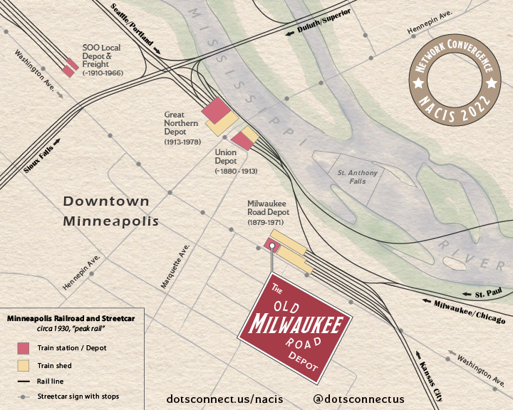
The Milwaukee Road rail line had a long history. It’s official name, which tells you more about its geographic range, is the Chicago, Milwaukee, St. Paul and Minneapolis Railroad. The line ran through the Milwaukee Road Depot in Minneapolis, which was itself a convergence for many other train lines.
“The Depot” is also the host of the NACIS 2022 conference. This inspired me to create a map that dug deeper into this rail-focused past and connected it with its present use.
Theme
This map is meant to show just how prevalent rail was in Minneapolis through its peak in the 1920’s. This includes longer haul railroad and local streetcar lines. After this peak, the highway system came online and rail use, both passenger and freight, started to dwindle. But at one time there were at least 4 significant freight depots or trains stations just in the downtown Minneapolis area, serving 10’s of thousands of passengers a day and a significant amount of freight.
For the NACIS event, people would be coming from near and far, so the map imagines these people coming in on these rail lines of the past. Arrows show where they might have been coming in from.
Here’s a short list of the online sources I used:
Maps
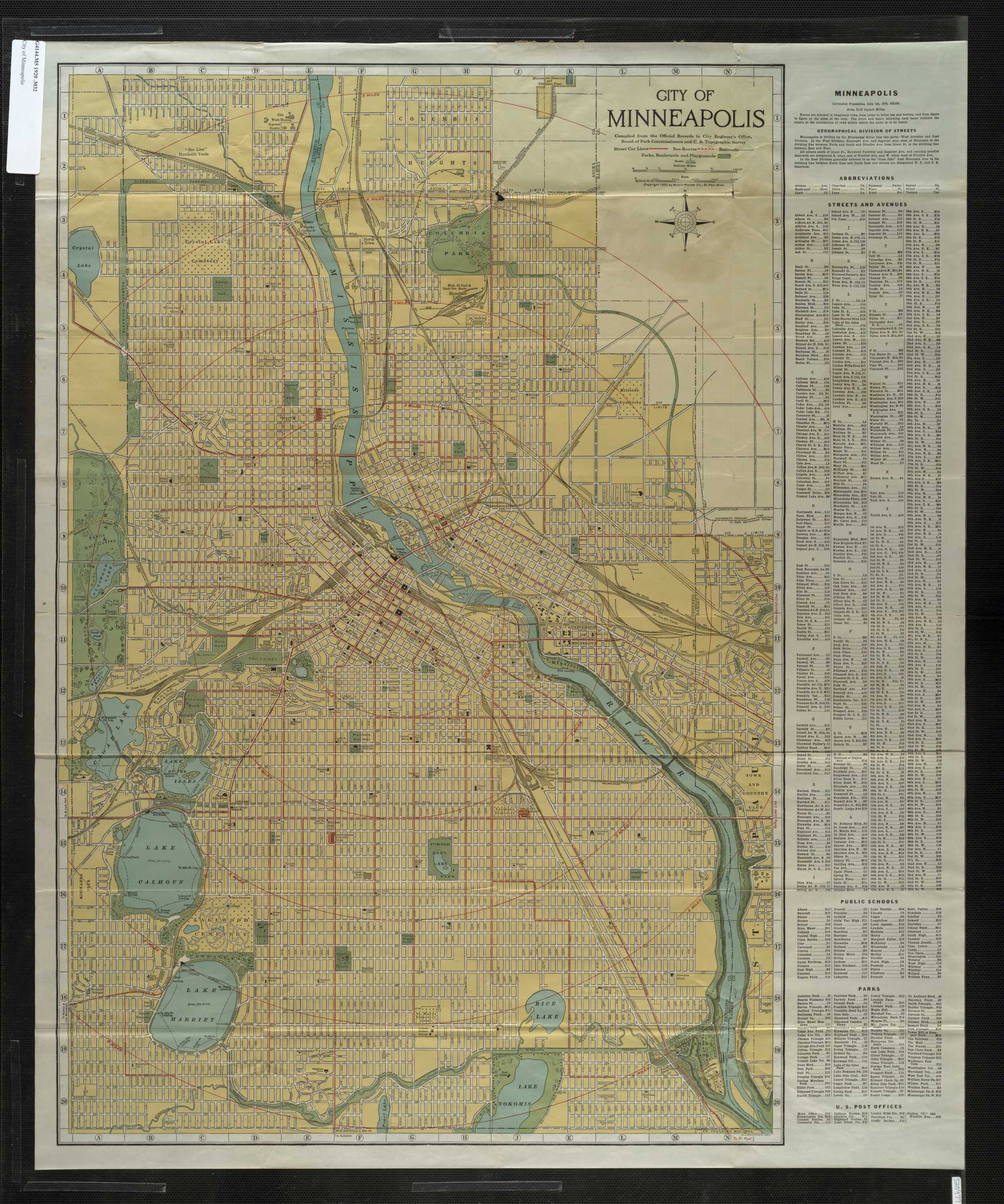
- City of Minneapolis (1919)
- Minneapolis and Vicinity (1924)
- City of Minneapolis (1910?)
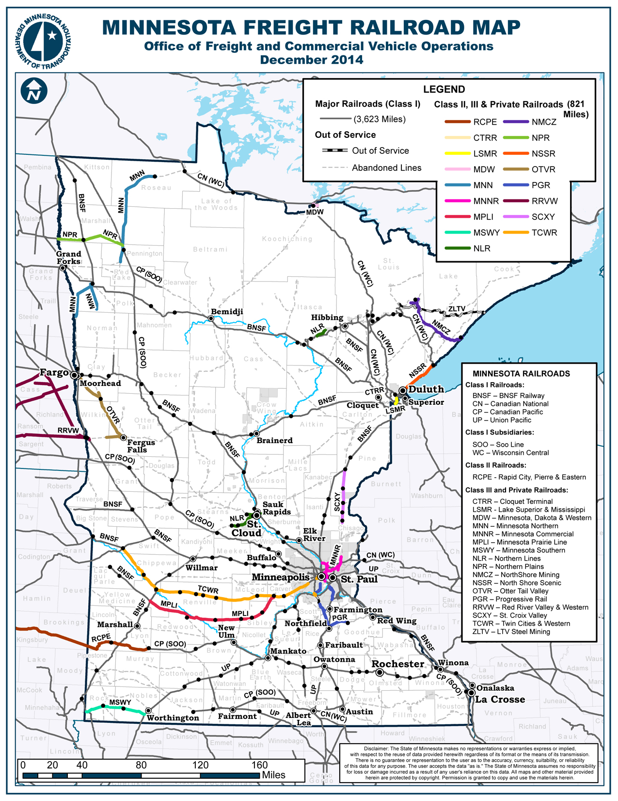
- Minnesota Freight Railroad Map (2014)
Articles and Archives
- Wikipedia - Milwaukee Station
- Wikipedia - Milwaukee Road
- Getting Around Minneapolis - Tracks of the Past
- Mill City Times - The Great Northern Depot
Inspiration
Process
My main sources were the rail line maps from 1910-1930. I georeferenced these maps and added some modern reference layers from Living Atlas. I then exported the whole package to Illustrator.
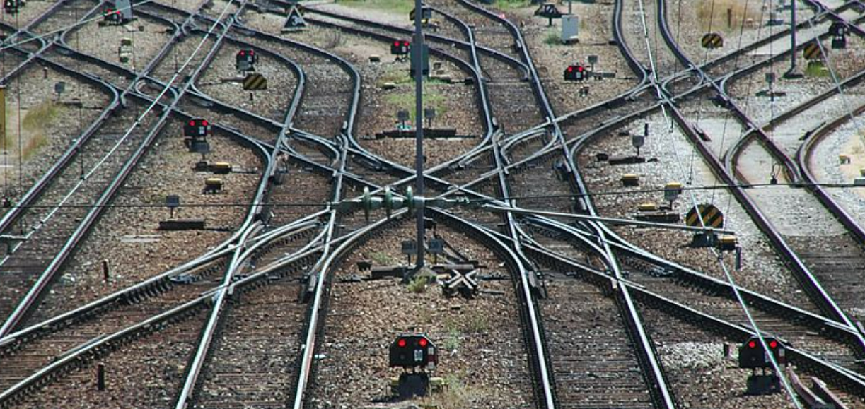
Now to me, rail lines are not rough, or jagged. They look and feel very smooth, strong. Long stretches of rail, sometimes as far as the eye can see, straight as an arrow with turns in sweeping arcs both long and short. To capture this, I used the Curvature Tool. I didn’t trace every track, far from that, but I did want to show that trains came and went from many directions and that stations could have multiple trains at the station at one time. In reality, near every depot has a “yard” with many parallel rail lines splitting and merging with each other, with switches upon switches to transition between. Here’s a picture just to give you an idea.
I chose not to include roads, buildings, and other elements of an early industrial city. The streetcar lines and a few street labels hint at the grid-like structure in place.
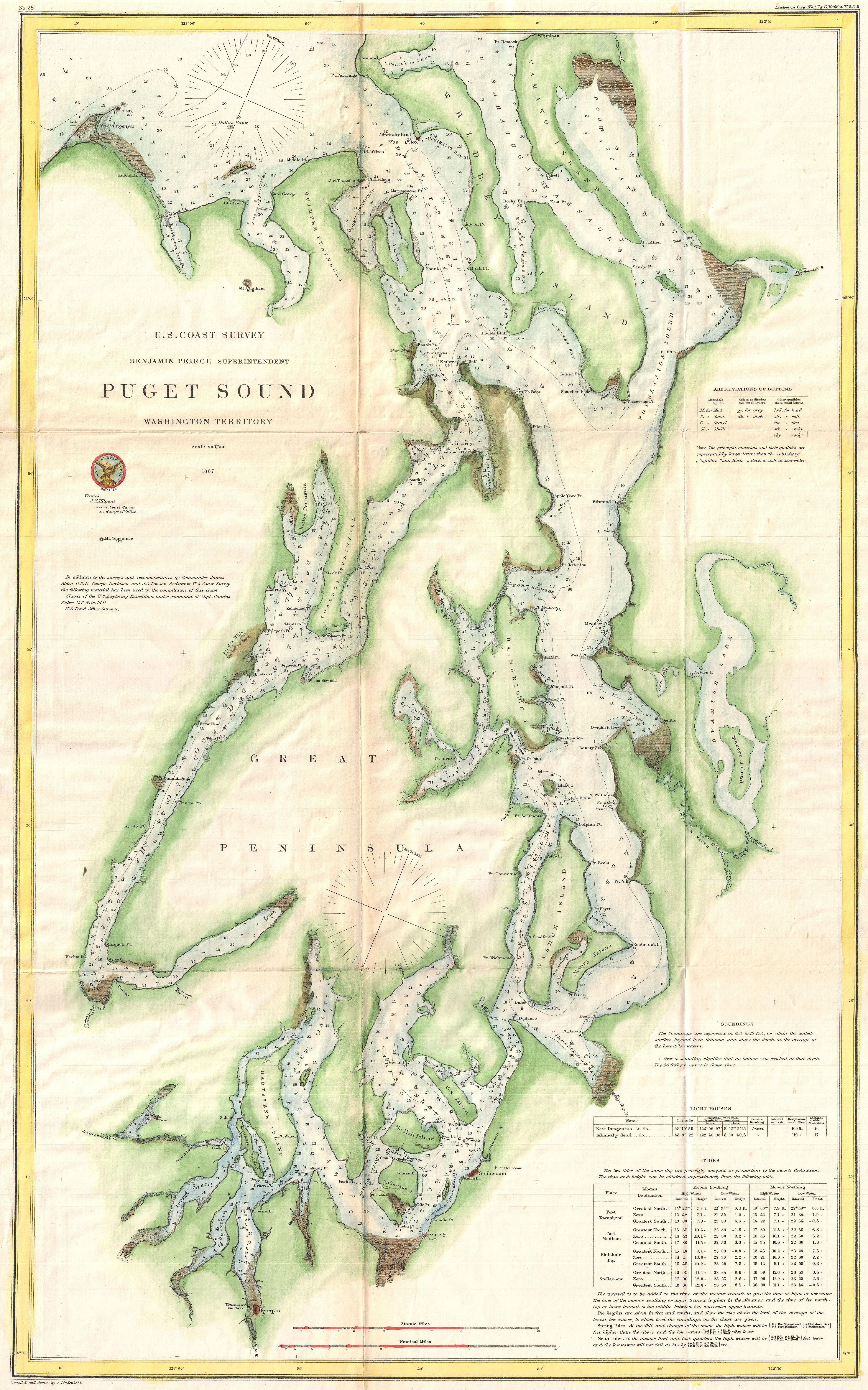
The watercolor background is a nod to survey charts from the later 1800’s that would be used to indicate waters, shoreline, etc. Just a splash of color to bring the otherwise simple linework and labeling to life. It’s a background element so a little goes a long way. I used Adobe Fresco with a Surface Pencil for this, though other software could certainly be used.
A Milwaukee Depot sign was created to round out the map and bring focus to the Depot itself as the center of attention. The layout and lettering of the sign is directly inspired by Milwaukee Road signs of the era.
Disclaimers
This map has not been expert reviewed, it’s based solely on online research, and historical maps that don’t always line up. It’s also not meant to be comprehensive:
- Roads and vehicle only river crossings were intentionally left out of the map.
- The railroad lines and streetcar tracks are not accurate in number or to a specific snapshot in time. The intention was to focus around the peak in the 1920’s and give a feel for just how rail focused the city was. Looking at enough maps, it’s clear that both large rail lines and streetcar lines were in flux through the 1920’s and 1930’s. By the 1940’s many of them were starting to be ripped out. The age of rail was over.