The Meeting
Back in February I attended a science forum in St. Lucia called Developing a Shared Vision for Improving Access to Information for Protected Area Management, attended by more than forty people from 13 Caribbean countries. It was one of those rare opportunities to listen to everyone talk about their activities and their many intersections.
One of the things I was surprised to learn is that there is at least 6 projects in the Eastern Caribbean developing an online system to support regional activities. Two of those are projects that I am actively starting on with Point 97 through The Nature Conservancy. And that doesn’t even count the systems setup at the national level!
The key issue that surfaced is that these systems were funded and planned independently, yet designed to support the same people with many of the same basic needs; including the planning, monitoring and evaluation of marine managed areas. During the forum, when all of the projects and their systems were presented in succession one after the other, people in attendance struggled to tell them apart and understand the differences. More importanly, they were concerned about the prospect of having to use and support a variety of overlapping systems to meet their needs. A natural response and not unexpected. Those of us responsible for designing these systems listened closely, shared notes, and set out to figure out how to work together to make the best of it.
Taking the Next Step
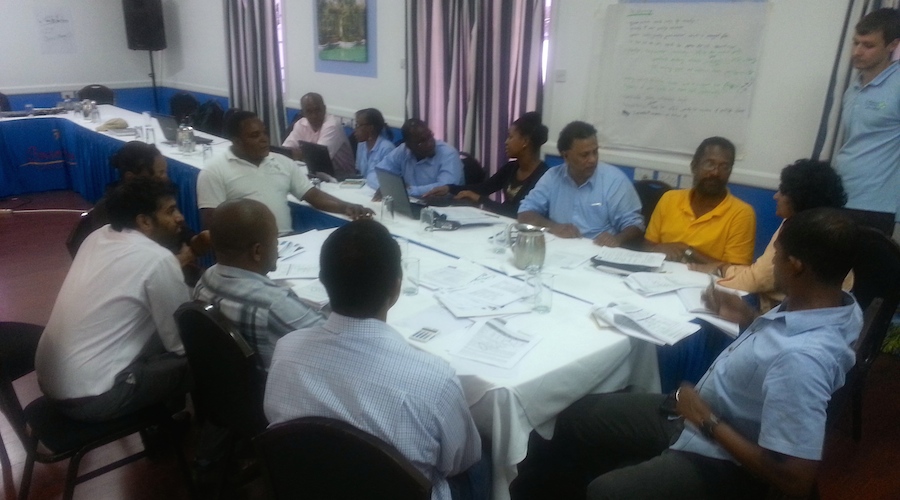
Last week I was in Barbados at the University of the West Indies meeting with a group of people representing four of the main regional systems under development. My main takeaway from this meeting is that we are all designing systems with data transparency (and security!) in mind through the use of web services and open standards. This makes the sharing of data possible and leaves the data providers and individual project stakeholders with the freedom to use that information as they see fit.
Here’s a brief synopsis of these regional systems with links to more information, the first two of which I am working on as a consultant with Point 97 through The Nature Conservancy:
| Project | Partners | System Description |
|---|---|---|
| 1.Eastern Caribbean Marine Managed Area Network - ECMMAN | 6 OECS countries, The Nature Conservancy, and more | Decision support system that provides accessible data and decision making tools and incorporates current ecological, socioeconomic, and climate change data |
| 2.Sustainable Financing of Eastern Caribbean Marine Ecosystems | 5 OECS countries, The Nature Conservancy, and more | Robust, transparent, user friendly, and cost-effective database platform built using GeoNode to support the effective monitoring and evaluation of protected areas. |
| 3.Biodiversity and Protected Areas Management - BIOPAMA | EC countries, IUCN, EU JRC, GIZ, UWI CERMES, and more | Caribbean regional observatory providing data and information to assist in better planning and decision-making with regard to marine and terrestrial protected areas |
| 4.Caribbean Marine Atlas | 9 EC countries, UWI CERMES, UNESCO, IODE | Joint initiative of 9 EC countries to identify, collect and organize available geo-spatial datasets into an atlas of environmental themes for the Caribbean region as a support service to the sustainable development and integrated management of marine and coastal areas in the region. |
Here’s the plan that is starting to take shape:
- Develop a single Geonode-based system that supports the needs of both the ECMMAN and the M&E Data Platform (projects #1 and #2 above), thus maximizing effort and minimizing duplication for two project that are working specifically with OECS countries in the Caribbean.
- Develop this system in collaboration with the World Bank Open DRI Initiative supporting the aggregation of data to the regional level that is produced by both regional and national partners (e.g. St. Lucia National Integrated Geonode,
- Identify key data and web services provided by each of the four systems, and publish them for use by the other systems with the approval of the data providers.
These meetings have been an important first step in uniting these projects which first and foremost intend to serve the needs of the individual countries and their goals of better managing their natural resources, their economy, and their communities. I find myself pleasantly surprised at the willingness of everyone involved to work together and find common ground with developing these systems. I think in many ways these types of systems still have a lot to prove in terms of their value to supporting work on the ground, which only motivates me further. I look forward to seeing what comes next.